In the southern foothills of the Macedon Ranges, just outside the township of Riddells Creek, is a surprising little patch of bushland that goes by the name of Conglomerate Gully Forest Reserve. The single 2.9-kilometre circuit trail in the reserve is popular with locals but not widely known elsewhere, which is why I’m so pleasantly surprised.
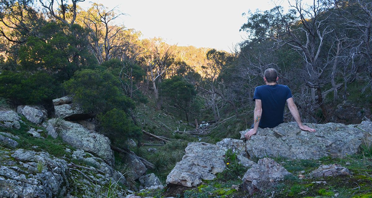
Conglomerate Gully is named for the spectacular exposures of conglomerate rock, at least 370 million years old, that feature throughout this hike. I can’t resist the urge to climb them and peer down into the gully at the barely running creek below. I’m planning to revisit after heavy rain, especially for the small unnamed waterfall, which I’m disappointed to see is only a trickle. If you do visit after rain, be careful because things will be super slippery.
Despite my late autumn visit, the wildflowers are putting on a show, but apparently, in the summer and spring they’re incredible with orchids flowering from October to December, and six (SIX!) species of wattle coming to life.
I encounter a few kangaroos and there’s a pair of Crimson rosellas that seem to be following me for the entire length of my walk. They say it’s common to see echidnas burrowing into the scrub alongside the trail.


Need to Know
Last Visited: 2020
Length: 2.9 km
Time: 1 hr
Grade: Easy-Moderate / Grade 3 (according to the Australian Walking Track Grading System).
Style: Circuit
Region: North-West Victoria
Park: Conglomerate Gully Forest Reserve
Closest Town: Riddells Creek
Car Access: The trailhead is at the end of Wheelwrights Road in Riddels Creek. Access to Riddells Creek is via the Calder Freeway. If using Google Maps, get it to take you to Wheelwrights Road rather than Conglomerate Gully Forest Reserve (I learned this the hard way).
Map: A trail map is available from the Macedon Ranges Visitor Information Centre. I visited with no map and you can’t really go wrong if you stick to the track.
Have you visited Conglomerate Gully? If you have any stories, updates or corrections, please let us know by commenting below.
Exploring the Great Ocean Road?
You won’t see the best sights from your car. Get the definitive guidebook, featuring the 25 best walks in the area with detailed instructions and maps.


hidden gem. good country
Thanks for the trail review Neil. When next I’m up that way I’ll give it a go. Looks lovely.
My pleasure, Robin! Hope you enjoy!