
Length (km): 3.1 km (according to MapMyWalk.com)
Time (hrs/mins): 1 hour
Grade: Easy
Return / Circuit / One-Way / Partial Circuit: Partial Circuit
Region: Melbourne
Park: Woodlands Historic Park
Closest Town: Greenvale
Ascent: 71m (according to MapMyWalk.com)
Maximum Height: 206m (according to MapMyWalk.com)
Map: Highlighted extract from ParkWeb Park Note (Woodlands Historic Park)
Further Details / Source(s): ParkWeb Park Note: Woodlands Historic Park
Getting There: I started this from the intersection of Mickleham Road and Swain Street. Take the Mickleham Road exit from the Tullamarine Freeway.
Comments: I didn’t study the map very well so when I got there I realised that Swain Street was fenced off but there was room to park my car so I walked from the intersection. About 250-300m up Swain Street there is a turn-off to Gellibrand Hill on the left and the peak is only about another 250m along. There are houses along Swain Street and there’s a massive radar tower (for the airport) near the peak, so it’s not the most natural of settings but is nice all the same. Near the peak I saw a huge Kangaroo which seemed quite annoyed by my presence so I took a couple of snaps and kept going.
I wanted to do at least a couple of km so I decided to walk in to the “Back Paddock” section of the park. The map was a little bit confusing on this part as it looks like it passes in and out of the “back paddock” fence (which is electrified) but it actually doesn’t, so I decided to just follow the fence along to the next opening. From there I walked back up a dirt road on the outside of the fence.
Overall it was an interesting enough short walk but I don’t think I’d do it again. Might look for some other walks in the “Back Paddock” section next time.

Angry Kangaroo

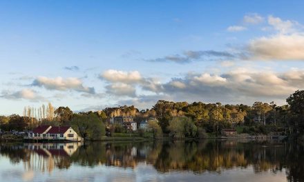
View of City from Gellibrand Hill


