
The most common feedback I get from readers of The Bushwalking Blog is that they “just want more hikes to do”. I get it – hiking is my passion too. I do more hikes than I’d ever have the time to write about, so that’s why I’ve decided Bare Bones Bushwalking is now a thing. Not every hike has a story I can attach to it and some I just don’t get around to writing up, so in an effort to share ALL of (or at least more of) the hikes with you I’m doing this. A more simplified blog post that gives you everything you need to go and do the hike yourself. Make your own stories.
Dandenong Ranges National Park is best known for it’s short, family-friendly hikes. This full day hike takes in parts of a few of those shorter trails, like the Channel 10 Track / Camellia Loop and Olinda Falls via Mechanics Track.
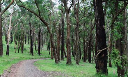
As is often the case in the Dandenongs, Lyrebirds were a feature for us, but almost every section of this day-hike was awash with all kinds of birdlife.
Tracks can be muddy and slippery after rain and track signage isn’t always reliable. Make sure you bring your hiking boots and a good map (see below for map advice).
The views across Melbourne’s skyline are incredible from Skyhigh Mount Dandenong, as well as the tracks on the west side of Mount Dandenong.
The short side-trip to Olinda Falls is absolutely worthwhile – A definite highlight of the walk.


Need to Know
Last Visited: 2013
Length: 15.6 km
Time: 5 hrs
Grade: Moderate / Grade 3 (according to the Australian Walking Track Grading System).
Style Circuit
Region: Melbourne
Park: Dandenong Ranges National Park
Closest Town: Olinda
Path Taken: Olinda-Monbulk Road – Chalet Road – Golf Course Track – Mathias Road – Predator Track – Bartlett Track – Falls Road – Cascade Track – Falls Track – Cascade Track – Mechanics Track – Kyeema Track – side track to Sky High Mount Dandenong – Kyeema Track – Channel 10 Track – Dandenong Creek Track – Ridge Road – Olinda-Monbulk Road
Car Access: Start from Olinda’s town centre, which is 10 km north of Upper Fern Tree Gully on the Mount Dandenong Tourist Road.
Map: You’ll need to grab this 1:25,000 scale topographic map which covers the area. If you’re happy to use your phone as your map you can download the free Avenza Maps app (on Android, iPhone, or Windows) and purchase the same map for AUD$2.99.
")
Have you visited Dandenong Ranges National Park? Got another idea for a long circuit hike in the park? If you have any stories, updates or corrections, please let us know by commenting below.
Exploring the Great Ocean Road?
You won’t see the best sights from your car. Get the definitive guidebook, featuring the 25 best walks in the area with detailed instructions and maps.


