This is the fourth post in the Aussie Hiking Bloggers guest post series for Bushwalking Blog. I’ve asked a bunch of other hiking bloggers to tell us about their favourite home turf day-walks.
Jill from the Gold Coast explains why Mount Cougal, bordering the state lines between Queensland and New South Wales, is her favourite bushwalking adventure. She blogs about her hiking trips at Walking the Gold Coast.
The Mount Cougal bushwalking track would have to be my favourite day walk adventure in the Gold Coast Hinterland. The best way to describe this bushwalk is that your only guide is the barbed wire fence that separates the two states of Queensland and New South Wales.
The terrain is diverse. Immediately after climbing the gate to start the bushwalk you are scrambling up the first hill. A hiking pole is highly recommended or you will be grabbing the first stick you can find or holding onto any shrubs that you can come across. Depending on the time of year and rainfall the vegetation can be dense and the ground wet and slippery.
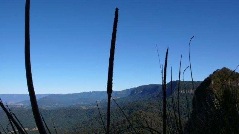
After the first short climb you enter a wild cane grass-like forest. Just beyond is your first picturesque plaque with sweeping 360-degree views down Currumbin Valley to the sea, northern New South Wales, and Mount Warning disappearing into a blue haze.
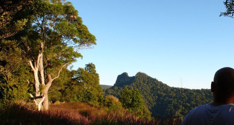
It is here on this grassy plateau standing in waist high grass that those mystic peaks of the Cougals become clearly visible.
On this occasion the Eastern Peak is our objective. Gazing at our destination the original names of these peaks springs to mind, Ningeroongun and Barrajanda, named after two hunting dogs.
Keeping the barbed wire fence to your left, there are times when you crisscross between both states where the fence has been flattened by fallen trees during violent weather that is so much a part of this beautiful bushland. A thunder storm can sweep around the scenic rim swiftly, dump its havoc and disappear, so be prepared!
The rain-forest section of the Mount Cougal bushwalking trail is spectacular, towering Red Cedars and bloodwoods testament to what lies in the valley floors below, those logging days when these beautiful trees were ripped from their ancient environment.
Finally you reach what seems to be a dead end; an impenetrable rocky outcrop at the base cliff of the eastern summit. At this point you must walk away from the fence, head right and negotiate the climb to the next ledge. However, before going on you should take a few minutes and head left to soak in the vista of the border ranges and Mount Cougal’s western peak looming above you.
Retrace your steps back and head right, along the base of the Eastern Peak’s cliff face; this is the most psychologically challenging part of the climb, there are no markers showing you the entry point to the final climb and it’s here that many fail to reach the summit. I might add there is a cave in this area that is worth investigating, you can see the western peak through an opening however the cave is easily missed.
Finding the access point to the Eastern Peak isn’t easy, but there is one hidden like the gate to a secret garden, with spear lilies concealing the entrance.
Upon arrival at Mount Cougal’s Eastern Peak the 360 degrees views are spectacular, Springbrook Plateau, the border ranges and beautiful Tweed Valley with Mount Warning far off in the distance. Through the Grass Trees (Xanthorrhoea) you can see the western peak waiting to be conquered, but that’s for another day….
Length (km): approx. 9 km
Time (hrs/min): 4-5 hrs (start early as light would be a problem in the late afternoon due to dense forest)
Grade: Difficult (Steep in sections. No signage. Only for experienced bushwalkers.)
Return / Circuit / One-Way / Partial Circuit: Circuit
Region: Gold Coast Hinterland (Queensland)
Park: Springbrook National Park
Closest Town: Currumbin
Car Access: Take Currumbin Creek Road for approximately 15km. Make a left turn into Tomewin Mountain Road and after the NSW tick gates watch for a sharp right turn into the Garden of Eden Road. This is a dirt track about 5 km long, narrow with heavy forest. The road ends at a gate. Park the car well away from the gate. Enter the gate and take a hard left and follow the border fence all the way up to Mount Cougal’s Eastern Peak.
Nearby: Purling Brook Falls is another incredible hike in Springbrook National Park.
Have you visited Springbrook National Park? If you have any stories, updates or corrections, please let us know by commenting below.
Are you interested in more from Bushwalking Blog? You can either sign-up for the e-mail newsletter, or get updates via the RSS feed, Facebook or Twitter.


