The most common feedback I get from readers of The Bushwalking Blog is that they “just want more hikes to do”. I get it – hiking is my passion too. I do more hikes than I’d ever have the time to write about, so that’s why I’ve decided Bare Bones Bushwalking is now a thing. Not every hike has a story I can attach to it and some I just don’t get around to writing up, so in an effort to share ALL of (or at least more of) the hikes with you I’m doing this. A more simplified blog post that gives you everything you need to go and do the hike yourself. Make your own stories.
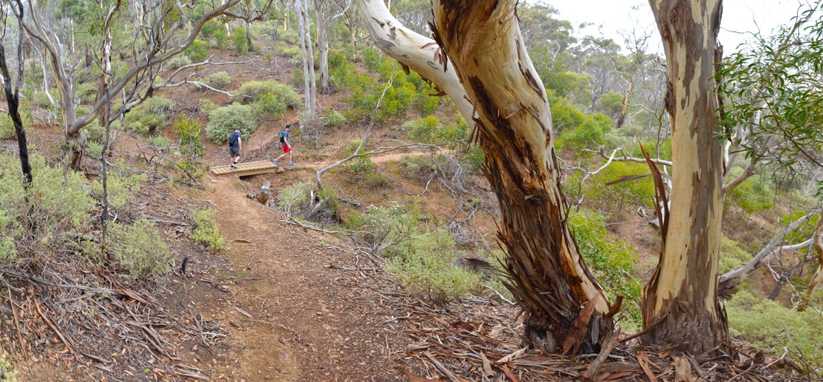
The Island (aka Centenary Track) is one of the lesser known hikes in Werribee Gorge State Park, but it’s worth a look if you want to see the incredible Werribee Gorge from a different angle.
When I first visited Werribee Gorge back in 2009, I was all alone in the park (as far as I could tell). This time, we struggled to find somewhere to park. Once on Centenary Track, though, there were far fewer people than on the apparently now very popular Werribee Gorge Circuit Track.
The Island itself is a volcanic hill, isolated by Myrniong Creek and the Werribee River. It’s not much to look at, having been previously cleared and now mostly being covered in long, non-native grasses, but efforts are being made to revegetate the area. Geology buffs will find the formation of The Island a significant feature.
The reason to climb The Island isn’t so much for the island itself, though. The views from the top are the real motivation. We didn’t get the full effect, unfortunately, since on the day of our visit it was foggy as hell. On a clear day, Island Lookout provides a view south-east through the gorge and even all the way to the hazy city skyline.
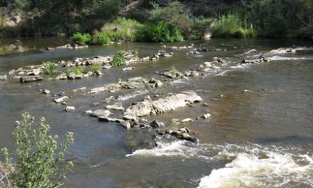
Junction Pool, where Myrniong Creek meets the Werribee River, is a brilliant spot for lunch. Apparently, you can occasionally spot platypus in the deep pool here.
We spotted an echidna alongside Centenary Track and the birdlife in the yellow gum forest there was incredible. Keep an eye out for snakes.


Need to Know
Last Visited: March 2017
Length: 7.8 km
Time: 3 hrs
Grade: Moderate / Grade 3 (according to the Australian Walking Track Grading System).
Style Partial Circuit
Region: Western Victoria
Park: Werribee Gorge State Park
Closest Town: Bacchus Marsh (14 km)
Path Taken: Quarry Picnic Area – unnamed track past toilet (part of the Werribee Gorge Circuit) – unnamed carpark near park entrance – Myers Road (for a very short distance to a gate on the left) – Centenary Track (leads to The Island and around the top in a loop) – retrace steps via Cemetary Track to Quarry Picnic Area
Car Access: From Melbourne, follow the Western Freeway, exiting at the Pentland Hills exit (5 km past Bacchus Marsh). Turn right, passing under the freeway and then turn left along Pentland Hills Road. This passes back under the freeway again, where you’ll need to immediately turn left into Myers Road. Follow this down into the park and at the first intersection, head straight to enter Quarry Picnic Area.
Map: All tracks are shown in Parks Victoria’s Werribee Gorge State Park Park Note.
Have you visited Werribee Gorge State Park? Got it on your bucket list? If you have any stories, updates or corrections, please let us know by commenting below.
Exploring the Great Ocean Road?
You won’t see the best sights from your car. Get the definitive guidebook, featuring the 25 best walks in the area with detailed instructions and maps.


