Length (km): 1.8 km
Time (hrs/min): 30 min
Grade: Easy
Return / Circuit / One-Way / Partial Circuit: Return
Region: Western Victoria
Park: Langi-Ghiran State Park
Closest Town: Ararat
Ascent: approx. 75 m (according to MapMyWalk.com)
Maximum Height: approx. 477 m (according to MapMyWalk.com)
Map: Shown clearly on Park Note below
Further Details / Source(s): Park Web Park Note: Langi Ghiran State Park – Visitor Guide
Getting There: Access is from the Western Highway between Beaufort and Ararat. Do not turn off where there is a brown and white tourist sign to Langi-Ghiran State Park. The walk is from Langhi Ghiran Track so you’ll need to take the next road to the East of that turn-off (Sandpit Road), which is not signed but can be easily found in relation to Colonial Road and the railway track crossing (under the road). Use the map on the ParkWeb Park Note above.
Comments: Though very short, this walk is worthwhile for the shelter and rock art. The track climbs gently up and is very easy to follow (a few other tracks cross but just follow the biggest, most well-established one). Part of the track borders farmland but other than this, the scenery is really nice.
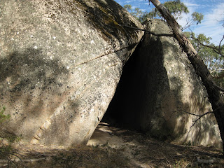
At the end of the track are two very large boulders which the Ngutuwul balug (Mountain people) clan used as shelter. On the other side of the boulders is the painting (shown in my photo below), which is quite faded and surrounded by a cage to protect it. Prior to the arrival of Europeans, the pictures were painted over but the practice ceased at this point in time. The meaning of the paintings is not known.

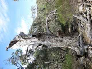
Tree along the track to the shelter

Lar-Ne-Jeering Shelter

Rock art


Thanks for checking out my blog. I had a read of yours and Langhi Ghirin definitely looks like somewhere I need to get back to for a bit more exploring.
Langi Ghirin State park is a great place to walk and explore. We followed your footsteps Neil and had a look at the art work then we headed cross country and climbed over the 2 peaks. I will be taking the family back there for a camping weekend. For info on my walk have a look at thewaz19.blogspot.com