
There are no official walking tracks in the park, so the first seven kilometres of this trail follows management vehicle tracks. The remainder is off track, mostly following the river. The vehicle track section doesn’t detract much from the walk. The open woodland here is dotted with alluvial diggings and is colourful in the warmer months when it comes to life with wattles, orchids, and other wildflowers.
Not too many people know about this little pocket of remnant bushland, so you’re unlikely to come across anyone else. We spotted our fair share of kangaroos and echidnas though.
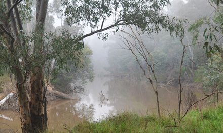
Following the ridges overlooking the river will make for easier going as there is much less scrubby vegetation. After Ballark Picnic Area you’ll need to head north-west and stay relatively high above Bungal Creek. You don’t want to descend too far into the valley.
Be careful of the diggings that are scattered throughout the forest, but also keep an eye out for stone chimneys and other relics of the area’s gold mining history.


Need to Know
Last Visited: 2012
Length: 12.7 km
Time: 5 hrs
Grade: Moderate – Difficult / Grade 5 (according to the Australian Walking Track Grading System).
Style Partial Circuit
Region: Western Victoria
Park: Bungal State Forest
Closest Town: Ballan (50 km)
Path Taken: Crossing Track – Ballark Track – Koolooroo Track – off track along Moorabool River East Branch – Ballark Picnic Area – off track away from the river, north-west to join Crossing Track again – Crossing Track to car park.
Car Access: From Melbourne, follow the Western Freeway for 76 km to take the Ballan turnoff. Continue south along C141 towards Geelong for 4 km. Turn south onto Ballan-Meredith Road and continue for another 18 km, before turning right onto Egerton-Ballark Road. After about 3 km you’ll cross a bridge over the Moorabool River East Branch and then continue for another 1.5 km to an unsigned vehicle track on your right. Follow this track until you see a grassy car park on your left.
Map: The only map I’ve found that covers this park is VicMap’s Ballan South 1:25,000. If you’re happy to use your phone as your map you can download the free Avenza Maps app (on Android,iPhone, or Windows) and purchase the same map for AUD$2.99.

Have you visited Brisbane Ranges National Park? Got it on your bucket list? If you have any stories, updates or corrections, please let us know by commenting below.
Exploring the Great Ocean Road?
You won’t see the best sights from your car. Get the definitive guidebook, featuring the 25 best walks in the area with detailed instructions and maps.


