
Growing up on the Mornington Peninsula, I’ve experienced all the stunning landscapes and outdoor activities it has to offer. From the rugged cliffs of Cape Schanck to the peaceful estuaries in Mount Martha, the Mornington Peninsula has an incredible diversity of landscapes that are perfect for experiencing on foot.
Less than an hour from Melbourne, the Mornington Peninsula is the perfect escape for those seeking day trips or weekend adventures. If you’re the outdoors type, you’ll love the Mornington Peninsula hikes.
Setting out on one of these trails, you’ll quickly understand why the Peninsula is so loved by residents and visitors alike. Whether you’re an experienced hiker or just looking for a leisurely stroll, there’s a trail here for everyone – some of them even allow you to bring along your four-legged friends.
Table of contents
- The 5 best Mornington Peninsula hikes
- Cape Schanck via Two Bays Walking Track
- Bushrangers Bay via Cape Schanck
- Point Nepean Walk
- The Two Bays Walking Track
- OT Dam Circuit Walk (Arthurs Seat)
- Other Mornington Peninsula hikes
- When to go for a Mornington Peninsula walk
- Other Mornington Peninsula activities and attractions
The 5 best Mornington Peninsula hikes
Let’s discover some of the best walking trails on the Mornington Peninsula. Look no further for all the details you’ll need to set off on one of these scenic adventures yourself. Whether you’re an experienced hiker or a beginner, you’ll find a suitable track below.
Cape Schanck via Two Bays Walking Track

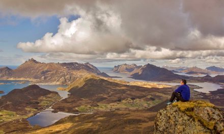
Although it’s in close proximity to Melbourne, a walk to Cape Schanck via Two Bays Walking Track offers a striking contrast to the city hustle. This moderately challenging trail leads you through diverse landscapes, from rugged coastal cliffs to peaceful forested areas.
Walkers can expect to encounter a variety of native flora and fauna along the way, including coastal shrubs and perhaps a few local bird species.
One of the trail’s highlights is the captivating view of Bushrangers Bay but, if you enjoy that, wait until you arrive at Cape Schanck. This trail is part of the larger Two Bays Walking Track in Mornington Peninsula National Park. It’s suitable for most walkers.
A walk to Cape Schanck via Two Bays Walking Track offers a delightful outdoor experience not far from the comforts of city life.
Need to Know
Length: 12.6 km
Time: 4 – 5 hrs
Grade: Moderate / Grade 3 (according to the Australian Walking Track Grading System).
Style: Return (or organise a car shuffle for a 6.3 km / 2 – 2.5 hr one way hike)
Access: The Bushrangers Bay section of Two Bays Walking Track is accessed from a car park on Boneo Road, about 7 km from Flinders.
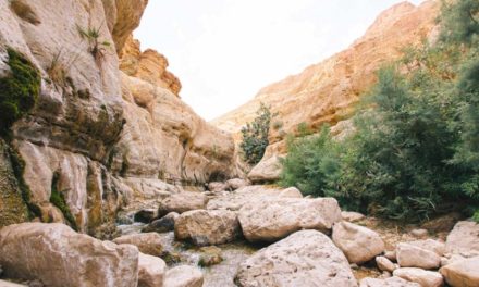
Bushrangers Bay via Cape Schanck

The Bushrangers Bay via Cape Schanck trail promises a rewarding hiking experience that melds coastal beauty with native bushland. The trail ambles along the cliff tops from Cape Schanck Lighthouse, eventually reaching the shores of Bushrangers Bay, where a sandy beach lies hidden away from roads and tourist stops.
As you explore the trail, be prepared to be serenaded by the sounds of local birdlife and the rustling of native vegetation underfoot.
This trail also uses a section of Two Bays Walking Track and covers much of the same ground as the Cape Schanck via Two Bays Walking Track (but in the opposite direction). Due mainly to the steps down to Bushrangers Bay – and, more importantly, back up again – you’ll need a reasonable level of fitness and agility.
Need to Know
Length: 7 km
Time: 3 hrs
Grade: Moderate / Grade 3 (according to the Australian Walking Track Grading System)
Style: Return
Access: The walk starts and finishes at the Cape Schanck car park, which is accessed via a signed turn-off from Boneo Road (aka Rosebud – Flinders Road).
Further info: For a more detailed description of this trail, read our previous Bushrangers Bay via Cape Schanck article.
Point Nepean Walk

The trail meanders along serene bayside coastline with historic structures along the way, climbs to the park’s highest point for views over the rugged Bass Strait coastline, and visits Fort Nepean – a haunting wartime relic nestled in the rocky headland. It’s an incredible park blending nature’s allure with echoes of the past.
Need to Know
Length: 7.75 km
Time: 3 hrs
Grade: Moderate / Grade 3 (according to the Australian Walking Track Grading System).
Style: One-way (use the shuttle bus service to return – details below).
Access: This walk begins from the car park at the entry to Point Nepean National Park, at the west end of Point Nepean Road in Portsea. The trail is accessed via Lentell Avenue, off Point Nepean Road in Sorrento. Start walking from the trailhead at the west end of the car park, which follows alongside Defence Road (don’t walk along Defence Road).
Path Taken: Park entry – Quarantine Station – Coles Track – Cheviot Hill – Happy Valley Loop – Defence Road – Fort Nepean.
Further info: Check out our Point Nepean Walk article for a more detailed overview of this trail, including many of its variations.
The Two Bays Walking Track

The Two Bays Walking Track is an iconic trek on the Mornington Peninsula, perfect for those seeking a two-day hike or a challenging full-day adventure.
This extensive trail offers a little bit of everything, from dense woodlands to open fields and panoramic coastal views. Covering a variety of terrains, it’s a rewarding challenge for the more experienced hiker.
Given the trail’s length and varying difficulty levels, planning ahead is essential. For starters, you’ll want to organise a car shuffle if possible. If you’re planning to walk it over two days, you’ll also need to decide whether to camp at Lightwood Creek Camping Area or make it a luxurious hike and find some local accommodation.
The Two Bays Walking Track is an excellent way to experience the Mornington Peninsula’s diversity of landscapes and ecosystems.
You’ll explore everything from lush forests to rugged coasts, taking in the heart of one of Australia’s most beautiful coastal regions.

Need to Know
Length: 26 km
Time: 8 – 10 hrs / 2 days
Grade: Difficult / Grade 4 (according to the Australian Walking Track Grading System).
Style: One-way
Access: The Two Bays Walking Track can be traversed in either direction, starting from Dromana Beach or Cape Schanck.
OT Dam Circuit Walk (Arthurs Seat)

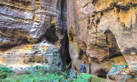
The OT Dam Circuit Walk would have to be one of the least visited trails on the Mornington Peninsula. Tucked away in the depths of Arthurs Seat State Park, it’s an excellent choice for those who prefer solitude on their hike.
Stroll through tall Eucalypts to a hidden gully, where a dam built in 1934 is hugged by dense forests and attracts diverse water bird species. Stroll along the boardwalk, skirting the dam, spot birds and other wildlife, and make sure you pause to soak up the serenity.
Need to Know
Length: 3 km
Time: 1.5 hrs
Grade: Moderate / Grade 3 (according to the Australian Walking Track Grading System).
Style: Circuit
Access: The OT Dam Circuit is accessed via a carpaark on Arthurs Seat Road (near Main Creek Road). Search Google Maps for ‘527 Main Creek Road’.
Other Mornington Peninsula hikes
Arthurs Seat Circuit Walk
The 1.8-kilometre Arthurs Seat Circuit Walk is the perfect spot for a stroll with the kids, taking in some of the best views you’ll find from the Mornington Peninsula’s highest point. To find its trailhead (opposite the Arthurs Seat Eagle Summit Station), either drive to the summit or catch the Arthurs Seat Eagle gondola.

Baldry’s Circuit
Baldrys Circuit is another relatively unknown trail in the Greens Bush section of Mornington Peninsula National Park. It’s a tranquil 3.6 kilometre track (with a 1.6 kilometre shortcut version) that’s absolutely teeming with wildlife. Whether you take the shortcut or hike the entire length, you’ll find a surprise around every corner.

Tea Tree Creek Walk

The Briars
If you’re looking for a dog-friendly walk on the Mornington Peninsula, look no further than The Briars at Mount Martha. The large network of trails at The Briars means you can choose your own adventure to make a walk of anywhere up to 4 kilometres. The park is particularly popular with birdwatchers.

When to go for a Mornington Peninsula walk
The Mornington Peninsula experiences a temperate climate, which means it’s suitable for outdoor activities almost all year round. However, the weather does vary from season to season…
Summer (December to February): The region experiences warm temperatures that can sometimes soar. While the coastal walks can be quite refreshing during this season, some of the inland trails might feel hot and humid. Walk on a hot day, and you’ll be rushing to the beach as soon as you return to the car.
Autumn (March to May): With mild temperatures and minimal rainfall, autumn is a good time for bushwalking. The autumn foliage adds a touch of magic to your walks.
Winter (June to August): Winter walks can be absolutely beautiful if you don’t mind bundling up. You won’t see as many other people on the trails, but you’re more likely to be cold and wet.
Spring (September to November): Much like autumn, spring brings mild temperatures and blooming wildflowers, making it a great season to check out these Mornington Peninsula hikes.
Other Mornington Peninsula activities and attractions
If you want to make the most of your Mornington Peninsula stay and explore more than just hiking trails, there’s no shortage of other reasons to visit. The region is famous for its fresh produce and seafood, wineries, and eateries.
Visit a local farmers market or community arts and crafts market, where you’ll be able to sample and purchase fresh produce directly from the growers. Or hop between the cellar doors of the wineries that dot the Peninsula, renowned for their Pinot Noir and Chardonnay. If galleries are your thing, you’re in for a treat, with local artists showcasing everything from paintings to sculptures.
In summer, the calm waters of Port Phillip are ideal for swimming, kayaking, and standup paddleboarding (SUP). Popular spots include Dromana and McCrae. Make sure you choose a dog-friendly beach if travelling with a four-legged friend.
If you’re looking to get the adrenalin pumping, try your hand at Tree Surfing at the Enchanted Adventure Garden.
After a day of exploring, nothing beats soaking in natural thermal mineral waters at Peninsula Hot Springs. This award-winning attraction provides a unique and rejuvenating experience.
Have you visited the Mornington Peninsula? Got any of these hikes on your bucket list? If you have any stories, updates or corrections, please let us know by commenting below.
Exploring the Great Ocean Road?
You won’t see the best sights from your car. Get the definitive guidebook, featuring the 25 best walks in the area with detailed instructions and maps.


Thank you for sharing such an insightful blog.