Length (km): approx. 20.5 km (according to MapMyHike.com)
Time (hrs/min): 6 hours
Grade: Moderate
Return / Circuit / One-Way / Partial Circuit: Partial Circuit
Region: North-East Victoria
Park: Alpine National Park
Closest Town: Mount Beauty
Maximum Elevation: 1,986 m
Total Ascent: approx. 1,324 m (according to MapMyHike.com)
Car Access: From Mount Beauty, head back towards Wodonga on the Kiewa Valley Highway for approximately 6 km and turn right into Ryders Lane / Mountain Creek Road. Follow this for another 10.6 km to park at Mountain Creek picnic and camping area, where the walk starts heading east on Mountain Creek Track.
Map: I’d recommend purchasing Spatial Vision’s Bogong Alpine Area – Outdoor Recreation Guide (1:50,000) before setting off on your walk. If you take part in any future Conquestathon, you will be provided with a map and navigation assistance by volunteers. If you’re happy to use your phone as your map you can download the free Avenza Maps app (on Android, iPhone, or Windows) and purchase Spatial Vision’s map for AUD$17.99.
No alcohol for the entire month of February? Sure. No problems at all… No alcohol on my (10th of March) birthday, after not drinking for the entire month of February? HELL NO!
Well at least that’s what I initially thought to myself when I received an e-mail about the Mount Bogong Conquestathon, which was to be held the day after my birthday. Eventually though, I decided that the Conquestathon was the perfect excuse to hike Mount Bogong for the first time. Not to mention a much healthier way to spend my birthday weekend than the usual drunken antics.
I was happy to be supporting such a great community event and, since it can be hard to round-up mates to hike with me (especially when the hike is so far from Melbourne), I was glad that I wouldn’t be hiking alone. Over 150 people took part in this year’s Conquestathon, so there was no shortage of people to talk to.
So the night of my birthday didn’t turn out to be much of a party. I treated myself to a hotel room in Mount Beauty and worked on the blog for a few hours before I hit the sack. I must be getting old! Having said that, I was extremely glad of my quiet night the next day, when 3 km into the circuit, I started to ascend Staircase Spur.
Over around 5 kilometres, Staircase Spur increases in altitude by just over 1,300 metres, to the summit of Mount Bogong. Hungover or not, that makes for a tough climb. The spur is named as such because it isn’t all steep, and does actually level out in some sections. This is possibly the only reason I made it beyond the first kilometre.
By the time I reached Bivouac Hut, with my legs burning and beginning to turn to jelly, I was extremely glad to hear one of the volunteers say that we had passed the steepest section of the spur. With this in mind, the rest of the climb would be much less trying.
While I was resting briefly at Bivouac Hut, panting and drenched in sweat, a trail runner appeared and was ticked off at the checkpoint. He didn’t even seem out of breath, and had barely broken a sweat. I had guessed who he was before I heard a whisper from the one of the other hikers resting near me… “That’s Andy Kromar.” Andy is a local DSE-employee, who holds the Conquestathon record for running the circuit in 1 hour and 51 minutes. I watched in silent reverence as he continued on his way. Nutter.
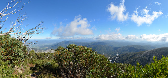
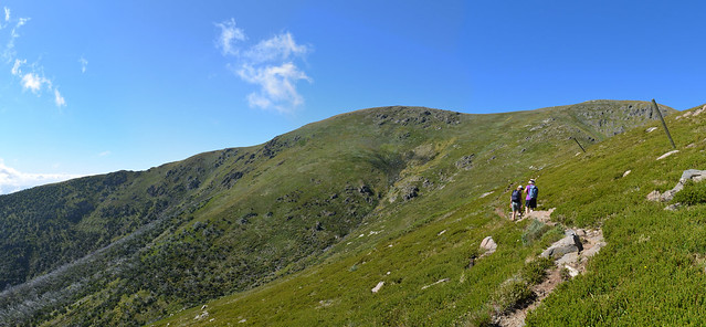
Though the remainder of the trail to the summit was a little easier, I found myself stopping more often than I had previously been. The vegetation thinned out as the tree-line approached, and the views made that burning sensation in my legs (and in my ex-smoker’s lungs) all the more worthwhile. Once beyond the tree-line, I could barely walk for a couple of minutes without stopping to turn around and take in my surroundings. On a perfect day you can see as far as Mount Kosciuszko from Mount Bogong’s summit. This day wasn’t quite so clear, but the views were still enough to take your breath away (had the climb not already done so).
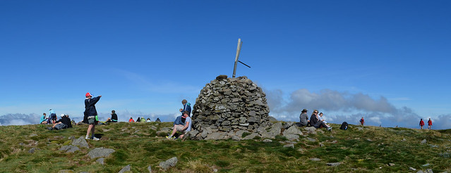
Following the snow-poles and the fairly well-worn track, I soon found myself at a track junction (at pole 1278), and continued a few hundred metres west to the summit cairn. As would be expected, this is where most hikers had chosen to take a break and have their lunch, and it was impossible to get a photo of the cairn without a whole bunch of people in it. Some thick cloud had also started to roll in, so I took a few quick photos and headed back east to continue the circuit.
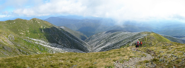
About 600 metres from the summit is where the track intersects with Eskdale Spur. I didn’t have to use my brain here, since volunteers were waiting to point it out to me, but on any other day you’ll need to keep an eye out for a snow-pole on your left (no track can be seen at this point). This marks the beginning of the descent route. This is probably the most stunning section of the walk. I found myself constantly torn between looking at the views and watching where I was putting my feet. Taking your time here is advisable as the spur is very steep.
Unfortunately by this stage my legs had completely turned to jelly and I was barely able to control them at all. Once I was back below the tree-line and the best of the scenery was behind me, my descent was much quicker than I would have liked. One fellow hiker commented that I should be taking my time and enjoying the walk, but it wasn’t that I was in a hurry. A mixture of jelly legs, gravity and the steep spur was leaving me no choice.
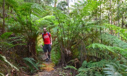
I was very glad to see an intersection with a 4WD track at Camp Creek Gap, as this marks the end of the of the steepest section of descent. From here I enjoyed heading west through an attractive ferny gully (for about 600 metres), before again coming to the 4WD track. This track leads all the way back to the Mountain Creek picnic and camping area. This section is a little dull, but flat walking was just fine with me at this stage of the day. The remainder of the trail includes a few river crossings, where I had no choice but to get my feet wet. This probably would not have been the case, had north-east Victoria not experienced so much rain in recent weeks.
The end of the walk was a happy sight for this unfit hiker, but as is always the case, the sense of achievement was not to be scoffed at. The all-to-familiar feeling of burning legs, which generally stays with me for a few days, is always a satisfying reminder of what I’ve achieved. On my return, Lions Club volunteers congratulated me and offered fruit and bottled water. I was also presented with a nice medallion. I can’t say I’ve ever had that at the end of a hike before. A big thanks goes to the Upper Kiewa Valley Lions Club.
This was one of the nicest hikes I’ve done in Victoria. I’ll definitely make an effort to go back when there’s a few less people around. For anyone who isn’t confident enough to set off hiking in alpine areas without assistance, The Mount Bogong Conquestathon is the perfect introduction. The only other way to see this area would be with a tour group, which would cost an arm and a leg. The entrance fee charged by the Lions Club is a very small price to pay. Even if you’re an experienced hiker, there’s no reason you shouldn’t take part in this excellent community event.
Have you ever visited Mount Bogong or taken part in the Conquestathon? If you have any stories, updates or corrections, please let us know by commenting below.






G’day Neil! Was just googling hiking Mt Bogong, and came across your post. Should have looked here first 🙂
I have decided to give this a go in 2020. My fitness isn’t anywhere near where it needs to be at the moment for this (I struggled bad with the uphills of the Ted Errey Nature Circuit this week lol), so if I work on building that cardio/hill fitness through the rest of this year and 2019, I might be ready to give it a go in 2020 🙂
Hey Kylie, that’s awesome to hear. It’s so good to have goals and Bogong is a very worthy goal! I was so proud of myself when I made it to the top and the views along the way were AMAZING! Good luck with your training!
Cheers
Neil
This is a bit of a belated post because I have only just looked up the Conquestathon out of ‘old-age’ curiosity and came across your effort.
I climbed Mt Bogong for the Conquestathon twice – 1969 & 1970 when with the Wodonga Senior Scouts – and was going to return in 1971 but that was never to be. I am now 64 so it will be curious (and horrendous physically) if I do make another effort sometime – and I would like to but who knows when.
So congrats on making the effort on climbing. For your information I took around 7 hours to do the first climb and 5 hours the second time. On the first climb we started at around 8am but when the 9am bunch passed us – before the hut on the way up – I kind of figured that we weren’t going to be amongst the major winners so ended up taking my time. The conditions and view that you have talked about and shown in your photos were exactly what I remember encountering on the first trip – and I assure you that I was stopping and resting and admiring the scenery (which was fabulous) as well. I stayed about an hour on the summit during the first trip. The way down seemed a lot quicker and faster but the two piles of jelly that were in fact my legs kept saying ‘take it easy, buster’ and naturally I had to give in. The second time I was a lot older and – allegedly – wiser and took pains to be a lot faster and hence the result. By the way I still have the certificates (somewhere?) of my ‘achievements. Incidently, I have climbed Uluru and Mt Koscuisko – but they’re stories for another day.
They you for your posts, I found them most entertaining – and agreeable.
Ian
Thanks so much for the message, Ian! Damn those jelly legs!
It’s amazing to think the Conquestathon has been going on for so long. What an amazing event.
I’d love to hear more of your hiking stories (as I’m sure other readers would) so please let us know if you ever feel like sharing.
Nice to hear from you.
Neil
How long did it take to go down from bogong summit via eskdale spur?
Hi Faith,
It’s been a bit too long for me to remember exactly now, but it was definitely a fair bit quicker than the climb. Let’s go with two hours or so. Hope that helps!
Cheers
Neil
Hi Neil
After reading your post on Mt Bogong I’ve decided to take the leap and attempt the 2016 one. I’ve very nervous but excited at the same time, and I just wanted to let you know that it’s this post which planted the seed and also gave me the confidence to attempt it.
I’m very very curious as to what to do about water. I’m currently taking a 3 liter camelback but I’m not sure if I’ll need more. Do you remember what you did for water? I’m a big water drinker as is, downing 3 ltrs easily a day and with exercise and a steep hill I’m not sure it will be enough.
Have you thought of doing the event again since you did it in 2012?
Really enjoy your website and I reference it often before going on a walk, thanks for the great website 🙂
Hi Bronwyn,
Thanks so much for your comments. These are the ones that keep me going, knowing that I’m actually helping and inspiring people.
I’m so glad you’ve decided to give Bogong a try… It’s the perfect day to do it, really. Don’t stress too much. There were much slower people there than me back in 2012, but they finished without any issues. They were just happy to take their time and have lots of rests.
I had a 1.5-litre bladder and a 700 ml bottle with me on my visit. That was plenty for me, but I probably don’t drink as much as I should. You could add an extra bottle to your supply but it’s a bit of a toss up considering the extra weight, so it’s really a decision you need to make. The good thing about the Conquestathon is that you’re not going to be left totally stranded if you run out of water, as there’ll always be someone close by to help.
I absolutely have thought about doing it again but I’d probably revisit solo as I’m yet to see Bogong without all the people and I definitely feel confident enough to do it now. Time is the only thing stopping me.
Good luck with the hike! I’d love to hear how you go.
Cheers
Neil
Hi Neil
Thanks for your Blog it was great to read all about what to expect and it really helped in me conquering it this year 2015. I couldn’t find friends to attempt it with, so the conquestathon was a great way to achieve another notch to my belt. I’m 54 and hope I’m able to keep up my fitness like Keith at 77. Thanks Kim
Nice one Kim! I think that’s the best thing about Conquestathon – having people to hike with, whether just for company or for safety. Well done for doing it and I hope you’re still doing it at 77 (I hope I am too!).
Thanks for the commment.
Cheers
Neil
Am 77 Neil. Pretty fit and jog every week. Bursting to have a go in 2015. What do you reckon? What footwear should I use? Other provisions?
Hey Keith,
I really really hope I can say the same at 77. That’s awesome. I haven’t updated all of the track grades on my blog posts to Australian Track Grading System standards but, if it helps you decide, this one would be a 4. If you decide to go for it, enjoy! It’s such a rewarding hike.
As for footwear, it wouldn’t hurt to get some good quality hiking shoes or boots (if you don’t already have some). Lots of people swear by the ankle support that boots provide, but I personally prefer shoes. It’s probably best to try some on and make the call based on how they feel.
Cheers
Neil
Does anyone know where the 1969 visitors’ book from Cleve Cole Hut is? Faint hope I know but stories of the construction of the snow pole line by Kore Grunnsund and Otto written by Otto Pinkas were in it and I would love a copy.
Gina Pinkas
Hi Gina,
That would be really interesting to see. I might post something on the social media channels. Will let you know if anything comes of it.
Cheers
Neil
Hi Gina,
Just letting you know that I had no response on Twitter or Facebook. Sorry I couldn’t be more help!
Cheers
Neil
Having attempted, and failing, this hike yesterday. I have strengthened my resolve to conquer Her. Have signed up for Conquestathon ’14 and can’t wait…. It was this blog post that set my curiosity in motion….
Keep up the awesome work 🙂
Cheers Mark
Hi Mark,
Cheers for the comment. 🙂 What happened on your failed attempt? Great to hear you’re having a crack at the Conquestathon! I’m always stoked when I can inspire someone.
Cheers
Neil
Neil,
the failed attempt up Bogong was due to a chronic problem I have with my feet. The skin under the ball of my left foot will, literally, crack open and bleed. Feels like I’ve stepped on nail or broken glass. The resulting pain makes it too difficult to walk. Having said that, I did a 30 something km hike thru the Brisbane Ranges last year without a problem…. The healing process is the most frustrating as it can take weeks, sometimes, to heal
Mark
Ouch Mark! That sounds horrible. Even worse than the old plantar fasciitis. :/ I’m very sorry to hear. Good luck with the next attempt!
Cheers
Neil
I hope you did the 2014 one mate! I’m thinking about doing the 2015 one 🙂
I hope you both get there! I won’t be able to get there again in the foreseeable future. Enjoy!
Cheers
Neil
Hi Neil,
Nice blog about Mount Bogong. 🙂 hope you can give me details to Mt.Bogong I also want to experience climbing that mountaing. May I ask if there a Mount Bogong Conquestathon for this year? Are they have schedule already? You can email me at chean.estanislao@gmail.com
Thanks,
Hi Chean,
Thanks for the comment. Everything you need should be in the post. If you have any questions, feel free to ask them here. I don’t know anything about climbing at Bogong, sorry. I’m guessing there was a 2013 Conquestathon, but it would have been in March. Not sure about 2014. You’d be best to get in touch with the Upper Kiewa Valley Lions Club.
Cheers
Neil
Well, you’ve bagged that one! Good effort to go up and down in the one day. I was knackered on my trip and preferred a sleep at Cleve Cole Hut, so I could get some rest before descending 🙂
Cheers Greg… Next time I’ll definitely make it an overnighter (and go along with a mate or two) but I was glad to take part in the event this time around.
Hey, thanks for the write-up. I think I might look up this route next time I’m in the area.
Mt Bogong is my most favourite destination in OZ, sadly I am only in Oz in winter and my snow and ice skills are lacking. But one day very soon I will revisit that very special mountain and hopefully watch the Bogong Moths and look down on the valley as I sip my coffee late in the evening.
BTW many years ago I was at Cleve Cole Hut and noted Steve Moneghetti’s comment, “what a great day for a run”. (I prefer to walk and I prefer Eskdale Spur, steeper but less frustrating)
Thanks for the reminder of what a special place Bogong is.
I much prefer a walk too… I do envy the fitness of these weirdos though! 😀
I’m so glad you enjoyed the post. Thanks for reading. I hope you get to come back at another time of year soon.
Cheers
Neil