Last Visited: 21/09/2010
Length (km): approx. 6.5 km (according to MapMyHike.com)
Time (hrs/min): 2 hours
Grade: Easy
Return / Circuit / One-Way / Partial Circuit: Return
Region: South-East Victoria
Park: Wilsons Promontory National Park
Closest Town: Yanakie (34 km)
Maximum Elevation: approx. 544 m (according to MapMyHike.com)
Total Ascent: approx. 336 m (according to MapMyHike.com)
Further Details / Source(s): Inspiring Gippsland Walks website. Also see ParkWeb Park Note: Wilsons Promontory National Park – Short Walks, Day Walks and Beach Access.
Car Access: Once inside the park gates, drive almost all the way to the camp grounds at Tidal River. Soon after a bridge crossing the river, the road splits and goes either right to the campground or straight/left to Telegraph Saddle Carpark. Head left and park at Telegraph Saddle, where the walk begins.
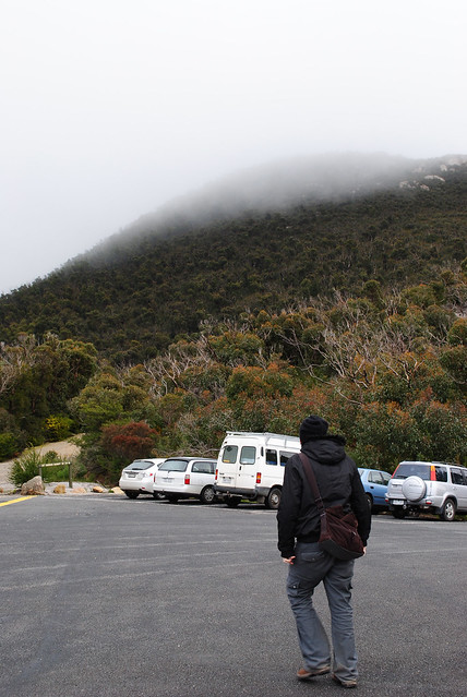
We could see Mount Oberon from our earlier walk at Lilly Pilly Gully and it was obvious that it wasn’t the best day to be doing the summit hike. While the summit looked amazing disappearing into the clouds, the highlight of the hike is supposedly the views so we felt a bit silly telling the other hikers we met in the car park where we were setting off to.
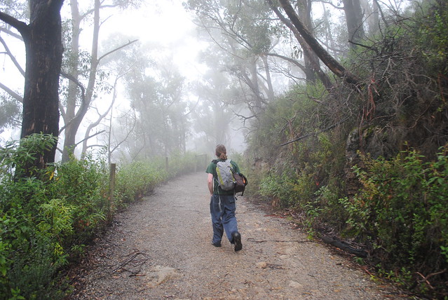
The drizzle started as soon as we left the car, so as a result I’ve got hardly any photos to show you unfortunately. The majority of the track to the summit is made up of a management vehicle track so the walking was easy, even though the climb is very steady. As we got higher up the track we found spots along the way where you could tell there would be very nice views but despite not being able to see them, we still enjoyed the eeriness of walking through the fog.
At the end of the management vehicle track there is an unfortunately placed mobile phone tower. Just past the tower you’ll find the beginning of a staircase which makes up the final climb to the summit. Beware of dangerous cliffs here, especially if it’s as foggy as it was when we visited. Once at the top, also beware of the high winds. Obviously we couldn’t see the view from the top but apparently on a clear day you can see all the way to Tasmania. I’ll definitely return to do the hike again so if I ever find a clear day to do it, I’ll be sure to post photos of the view (and more photos in general).
Note: This walk was part of a feature article that I co-wrote, which appeared in the February/March 2011 issue of Great Walks Magazine.
I was a guest of Tourism Victoria and Destination Gippsland during my trip to Wilsons Promontory. This does not influence the views that I put forward here in any way.
Accommodation Ideas:
- Wilsons Promontory Wilderness Retreats – A cross between tent and luxury bush-cabin, the Wilderness Retreats are the best accommodation available at Wilsons Promontory National Park. Unfortunately they have a price tag to match, so they probably won’t be the accommodation of choice for the average hiker. If visiting with a loved one for a special occasion, I recommend you consider them for something special.
- Tidal River Camping & Accommodation – This is the only other accommodation in Wilsons Promontory National Park, although there are other towns with accommodation outside of the park. I have never stayed here myself so I can’t really comment, apart from to say that Tidal River is a beautiful spot.
Related Walks:
- Lilly Pilly Gully Circuit was the only other walk that we had a chance to complete during our short stay at Wilsons Promontory.
- Update (9/1/2019): I’ve now publshed a guide to all the best walks in Wilsons Promontory National Park, along with everything you need to know to plan your trip.
Have you visited Mount Oberon? If you have any stories, updates or corrections, please let us know by commenting below.
Are you interested in more from Bushwalking Blog? You can either sign-up for the e-mail newsletter, or get updates via the RSS feed, Facebook or Twitter.


This was really great and i loved it
Glad you enjoyed, Aaron! Thanks for commenting. 🙂
Cheers
Neil