Map
Last Visited: 14/03/2011
Length (km): 13 km
Time (hrs/min): 6 hours
Grade: Moderate/Difficult
Return / Circuit / One-Way / Partial Circuit: Circuit
Region: Western Victoria
Park: Werribee Gorge State Park
Closest Town: Bacchus Marsh (11.5 km)
Car Access: From the main street of Bacchus Marsh, follow the signs to Geelong and then turn right at the roundabout just before the railway line (onto Griffith Street). Turn right into McCormack Road after approximately 2 km and after a further 2 km, turn right into Ballan-Ingliston Road (aka Ironbark Road). You will cross a railway line after about 6 km and after a few hundred metres there is a small carpark on the right. The hike is signed from here.
As I trudged my way up the steep spur towards Western Bluff, I was happy for this walk to be over. This was no reflection on the quality of the walk itself. In fact, I had already pronounced it my new favourite Melbourne day walk. It was more about the comedy of errors that the day had been for me. I basically felt like a massive tool.
I had been optimistic as we started the descent into Ironbark Gorge. Having walked a short stretch of it before and having seen Werribee Gorge from Falcon’s Lookout, I knew this was going to be a beautiful and challenging hike.
My good friend Lachlan had come along with me on this hike. I’d never taken him before and was excited to show him that it could be more fun than he seemed to think it would be. Upon reflection, I’m not sure that I succeeded in doing that but at the very least, I did give him a good laugh.
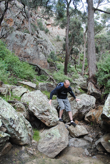
Rock-hopping our way down Ironbark Gorge was slow going, but I was enjoying the challenge. Since I was leading the way, I had the unfortunate job of clearing the trail of spider webs, usually with my face. This was bearable enough until one of the webs caused a stinging pain on my forehead. I put my hand up to my head, only to find that there had been a bee trapped in the web, obviously still with enough fight in it to sting me. I took comfort in the fact that it would now die. I was glad it had been me rather than Lachlan, since he’s severely allergic to bees.
Satisfied with the fact that neither of us was convulsing or unable to breathe, we continued on to Ironbark Gorge’s intersection with the Werribee Gorge and made our way east for a short distance to find a suitable place to cross the river. Soon we came to a narrower part of the river, where three or four large boulders were laid out as if purpose-built for river crossing. The only issue was their awkward shape, which meant we had to manoeuvre ourselves over and around them on all fours.
Standing up on the last boulder, I made the final leap to the east bank. I must have been fairly sure that I was safely on the riverbank, because I got quite the shock when I felt one of my feet slip out from under me, and realised I was about to be in the river. Thanks to a rock that I bounced off on the way down, I was able to keep the top half of my body mostly dry, saving my camera and phone from a watery death. I snapped a couple of photos of Lachlan as he crossed without difficulty and we continued south-east along the river. At this point, it’s safe to say that I was already dreading the day’s second river crossing.
Making our way to Miekles Point Picnic Area was the highlight of the walk, and surprisingly went by without incident. Flood debris made interesting obstacles to climb over and there were points where we had to cross narrow rock ledges, sometimes assisted by chains attached to the rock. When I arrived at the picnic area in one piece, I started thinking that maybe I’d had my fair share of accidents for the day.
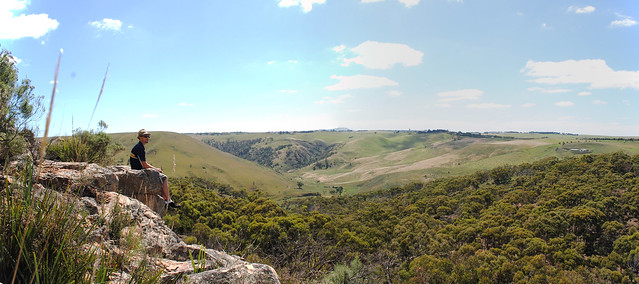
The high section of this circuit was easy walking. There are two lookouts along the way, the first looking over the farmland to the east, and the second looking over the gorge. Both would be excellent places to stop for a picnic, but we had already devoured the majority of our food by this point.
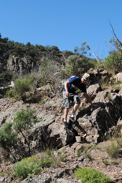
Soon after Western Viewpoint the track took us back into Werribee Gorge, down a beautiful rocky spur. This section of the gorge was not as attractive as what we’d already seen. It was overgrown with weeds and this made traversing the rocky riverbank all the more difficult. The next accident seemed inevitable, and it came when I least expected. Being the third one for the day it was, of course, spectacular. Catching my toe on a rock, I stumbled forward. This forced my shin onto another very sharp rock, causing a reasonable-sized gash. I tried to regain my footing but stumbled again. This time I knew I was going down. My first thought was the camera around my neck, so I held it up in the air. Unfortunately, the hand I was holding it up with probably could have saved me from face-planting – wait for it – into a rather large patch of stinging nettle.
As I got up, bits of nettle leaves and twigs clinging to my t-shirt, all I could do was laugh and assess the damage. My camera was perfectly fine, so I could be glad about one thing. The gash on my ankle didn’t really hurt, but I gave it a cleanup anyway. As I sat on a rock taking care of that, the effects of the stinging nettle were slowly setting in. The stings covered one of my forearms, one of my legs, and one side of my face. Very uncomfortable indeed. Still, I couldn’t stop laughing at myself.
There was only one thing to do – keep walking. We soon passed our initial river-crossing point and had to find the best place to cross, so as to make our way out of the gorge via Western Bluff. With no track in sight on the opposite side, we made a guess and crossed the river again. I had mostly dried off by this point and this time I managed to stay dry as I crossed. Hooray.
After a few failed attempts at bush-bashing our way to the spur, we eventually found the path of least resistance and then a trail marked with arrows on trees. The climb out of the gorge was tough but I was just glad that the day was coming to an end, and that my injuries hadn’t been more serious.
Note: This walk was also featured in Great Walks Magazine’s June/July 2011 issue.
- Falcon’s Lookout (& Ingliston Granites) is another excellent walk, which covers a nearby section of Werribee Gorge State Park.
Have you visited Werribee Gorge? If you have any stories, updates or corrections, please let us know by commenting below.


Neil, what a great day you have had. Really enjoyed the reflections of the journey you took. Gilson College (both Taylors Hill and Mernda campuses) operates a unique Learning4Life (L4L) program which begins at Werribee gorge for our Yr 9 students in the first week of school each year. We have had many wonderful experiences with the various cohorts over the past 15 or so years. It is the beginning of a varied and intense journey for students through self discovery, community awareness and into adulthood, an initiation to Experiential Education or Rite of Passage if you like.
The Werribee Gorge walk has a good deal of variety and interest, with magnificent rewards along the way, at the same time as providing a good challenge for a range of abilities. We follow up with a camping skills training week at Buangor State Forest along the Beerepmo track, then hone their navigation skills for a few days in the Fryers Ranges area all in Term 1, culminating the year in November with a Major Expedition in the Bogong High Plains. Prior to 2012 we went to The Walls of Jerusalem and the Great Pine Tiers in Tasmania for the Expedition.
The changes of life perception, personal awareness and resilience, group and community awareness and the development of a more positive approach to family and life in general and an openness to new experiences outside of their electronic devices and social media are enormously valuable and clearly evidenced. I am now retired but continue to assist in the L4L program.
Hey Chris,
Thanks so much for reading and especially commenting. L4L sounds amazing! My son has just started year 7 and I really hope his school does something like this down the track. He does Scouts and would get a lot out of a program like that. Sounds like you’ve explored some of the most incredible places with the kids, too. Glad to hear you’re still doing it despite your retirement.
All the best
Neil
Hi Neil
I had to smile reading your post about the Weribee Gorge. I did this hike last year with my partner the other way round. The point we were struggling most was to find the entrance of the Ironbark Gorge. There were no markings at all. Now looking at your pictures, I have just realised that we picked up the right track…but after walking for a long time without seeing any marking some doubts were coming up and we turned back to the entrance of the Ironbark Gorge. There was no time left to go all the way back where we started. We desperately searched for some markings but nothing and we worried about running out of time. So we had to take a risk and just climbed up a very steep hill (in fact we were so close to this Ironbark Gorge but walking above it!). By that time it was late afternoon and I was picturing ourselves already sleeping there out in the nowhere. I don’t know how we made it but we finally found the Falcon’s Lookout. Phew! That was an adventure and we were really glad that we made it out of this gorge!
Cheers,
Isa
Hi Isa!
Ugh. How unsettling is that feeling when you can’t find where you’re supposed to be going!? It does add to the feeling of adventure though, that’s for sure. Glad you made it out in one piece, and I hope it hasn’t put you off! Happy hiking!
Cheers
Neil
Oh…. now I realize we only did the long Gorge circuit and not the full trail you described. What a pity! Well we went the counter clockwise direction from Quarry picnic area, and it started out pretty dry and disappointing, but reaching the river and walking alongside it was beautiful and really made up for that. We also saw quite a few koalas (a first for us!)
I loved the rock scrambling bit, but here it was really only a small taste. Would love to do more of that, if you have any recommendations?
Glad you enjoyed, Anat, even if you didn’t do the full circuit. Cathedral Range is nice and rocky, as is Lerderderg Gorge. Maybe give them a try. Thanks for commenting.
Cheers
Neil
Sounds great! Thanks!
Having been inspired by your blog again Neil, I took on Werribee Gorge and Centenary Track. It was a bit of a rainy day so walking up the James Whyte Island reserve was a muddy and slippery challenge. Overall, one of the nicest and relaxing walks around Melbourne though. I can definitely recommend it. There are so many variations in the walk.
Will have to decide which of your walks to do next.
Great to hear you’re using the blog for inspiration, Xavier! I’ve wanted to check out James Whyte Island Reserve for a while. Looks lovely! Stay tuned for more walks coming soon!
Cheers
Neil
Nice work Neil. This walk sounds like it should officially be classified a ‘fiasco’!
Thanks Greg! Fiasco is an understatement! :/
LOL,I’m glad you’re good humoured enough to laugh at yourself. What a day… I thought I was the clumsiest hiker in town but you definitely win top prize! However, I am yet to meet someone who gets more lost while hiking than I do.
I’ve hiked to Falcon’s lookout and done the circuit (both the short and long circuit) from Miekles picnic ground. It’s one of my favourite walks around Melbourne with the different terrain you encounter, from sand to rock to traversing along the wire rope about a foot above the river. You can read about my adventures in the Werribee Gorge here: http://headingforthehills.com/2010/10/werribee-gorge/
Hi Sandra,
What can you do but laugh? Haha. Yep, Werribee Gorge is definitely still in my top 5 Melbourne day-walks. Beautiful place!
I don’t think I’d ever seen your blog before now. Thanks for letting me know about it.
Cheers
Neil
I don’t update my blog very often. I think I bit off more than I could chew with that blog. I do so much research before each hike that I thought I’d better start keeping track of all the stuff I read and interesting web sites I find and why not share it… All in good time, eh?
I know what you mean… I really enjoy blogging but I’ve got so much paid work going at the moment that I just can’t make it as much of a priority as I’d like. All in good time is right.