
From the Omeo Highway, head up the 4WD track towards the Mount Wills Carpark. This is the highest point of the Omeo Highway. Follow this for 1.7 km to a T-intersection, where you’ll find the Talangatta Ski Club on your left. The gated, overgrown track to your right is signed as “Mount Wills 3km”. This track is only open to management vehicles and walkers but I’m guessing there hasn’t been any vehicles for a while, since the track is badly overgrown. I didn’t have too much trouble getting through and after less than a kilometre, everything opened up nicely.

Part of the track (before reaching the Ski Club)
The track is easy to follow from here to the summit. I actually found the climb really challenging but my fitness isn’t quite what it was when I did the Inka Trail! The forest approaching the summit is a real highlight and the wildflowers were incredible at the time of my visit. You’ll know you’re near the summit when you see Mount Wills Hut. To your right you’ll find a great lookout and on your left before the hut, there are some huge granite boulders which also make for some amazing views.

A flower alongside the track

Another flower on the track

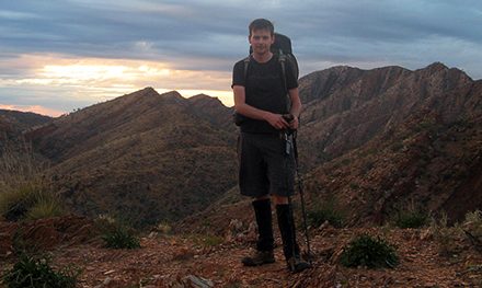
Mount Wills Hut (at the summit)

Views from Mount Wills Hut

Views from the granite boulders near the summit
I didn’t spot much in the way of wildlife except for some small lizards (I’m guessing skinks or geckos, a few crimson rosellas and a couple of wedge-tailed eagles at the summit. The highlights for me were the wild flowers, the views and just how different this country is to anything I’ve seen before.
Another map I was using (which I can’t seem to find now) seemed to suggest that the Australian Alpine Walking Trail (AAWT) crossed the Omeo Highway near where I started my walk but I was unable to find any “track” (I half expected this since I’ve read that the AAWT is very difficult to follow). Not far from the summit I did notice that the AAWT joined the 4WD track I was using and I also found where it continued on near the summit. Judging purely based on what I’ve seen of the AAWT today, I’m not too sure that this is a hike I’ll ever be able to undertake (even in small sections)! The Park Note also mentions the need to look out for mines in the area which has me wondering even more, just how dangerous the AAWT would be to undertake.
Another safety concern mentioned in the Park Note is that “Many roads and tracks are closed seasonally for environmental and safety reasons.” It is advisable to check up on current road closures (try Parks Victoria’s ParkWeb) and in the snow season, don’t go unless experienced in driving and navigating by foot in snowy conditions (and obviously carry chains).
Last Walked: 28/12/2009
Length (km): 9.4 km
Time (hrs/min): 3 hrs 30 mins
Grade: Moderate
Return / Circuit / One-Way / Partial Circuit: Return
Region: North-East Victoria
Park: Mount Wills Historic Area – Alpine National Park
Closest Town: Mitta Mitta
Car Access: I started walking from the corner of the Omeo Highway and Mount Wills Road (signed as “Mount Wills Carpark 1.7km”) which is about 42 km south of Mitta Mitta (from Mitta Mitta, follow the signs towards Omeo). A good reference point are the two signs marking the border between the two shires. I turned left at this intersection and found plenty of room to park my car.
I reached Mitta Mitta from Wodonga, via Talangatta. Some sections of the Omeo Highway (beyond Mitta Mitta) are unsealed but definitely accessable by 2WD. However, I would suggest only making the trip with an experienced driver.
In hindsight, I probably could have taken my car up the 4WD track but I was unsure of it’s condition. Had there been any fallen branches, I would have needed to reverse out as there was nowhere to turn around. Should you choose to drive up, the walk I’m describing would be shortened to 6 km. However, the initial climb is worth doing on foot, even if you do have a 4WD.
Map: Highlighted extract from ParkWeb Park Note (Alpine National Park – Source of the Rivers – around Mitta Mitta, Omeo, Talangatta and Corryong). This is actually not all that useful except for in finding the beginning of the track… The track is actually very easy to follow. The Park Note also recommends the following maps:
- Spatial Vision Touring the Victorian Alps 1:140,000
- VicMap 1:50,000 Omeo – Bindi, Benambra, Leinster, Dart – Gibbo, Alpine Area (Leisure Map)
- Natmap 1:100,000 Benambra and Jacobs River
Have you visited Mount Wills? If you have any stories, updates or corrections, please let us know by commenting below.


Did you see the copper plate engravement on one of the boulders that look out to the East(you walk out the hut door to the east..scramble up the rocks) James and Ellie Petersen. Not many would know of this!I know of the 2 entries of the AAWT off Omeo Hwy…we did the higher section a few years ago.(FROM ROAD TURNOFF TO MT WILL SOUTH TRIG)A lot of windfall …trees down over track (due to the fires).
Hi Marty,
I didn’t see the copper plate, no. Sounds interesting. Do you know who they were/are? Thanks for the update about the conditions!
Cheers
Neil