
Last Visited: 08/03/2010
Length (km): 2.5 km
Time (hrs/min): 1 hour
Grade: Easy
Return / Circuit / One-Way / Partial Circuit: Circuit
Region: Melbourne
Park: Yarra Ranges National Park
Closest Town: Healesville
Maximum Elevation: approx. 368 m (according to MapMyHike.com)
Total Ascent: approx. 99 m (according to MapMyHike.com)
Car Access: Badger Weir Picnic Ground is signed from the main street of Healesville (when entering from the Melbourne side). The easiest thing to do is follow the signs. Once at the picnic ground, you can park anywhere you like – I parked in the last car park.
The walk starts opposite the first toilet block, on the northern side of the picnic ground. Cross the bridge and head up the hill, turning left at the first intersection (onto Slip Track). From here, follow the signs to Badger Weir. This section is not exactly as it appears on the map, as there are a couple of well signed turn-offs.
There are only two tracks leaving the weir and you can take either of them, as they meet up not far away. I would suggest taking the lower track (ie. not up the stairs). Follow Aqueduct track up until a right-turn onto Coranderrk Track. Look out for a left turn onto Stringybark Track, which will take you back to the car park. All tracks are well signed.
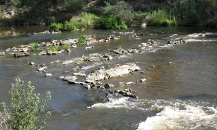
The weir is hardly the highlight of this walk, as parts of it follow a beautiful fern gully alongside a nice little creek. The less interesting part of the walk is the section along Aqueduct Track, where the forest is drier and not as dense.
I spotted a Lyrebird on Stringybark Track. It didn’t seem to be as shy as they usually are but I still couldn’t get a photo. Watch out for leeches… They are definitely less shy! I was pulling them off my legs every few hundred metres.

Aqueduct Track
Have you visited Badger Weir? If you have any stories, updates or corrections, please let us know by commenting below.


Drove there in Jan and the whole area still hasn’t been cleaned up since the 2016 storm in the area.
Toilet block and bbq area were destroyed and trees fallen everywhere.
You could probably still do the walk but we didn’t look.
Hi Clive,
Thanks so much for letting us know! I’ll do some research and either update or remove this post soon. Really appreciate the heads up.
Cheers
Neil
Nice walk – did it today with our 2 year old and he managed to walk about two thirds of it (shoulder ride or carried for the remainder). Up via Coranderrk and Aqueduct Track, back via Slip Track. It was damp and lush with the creek flowing over the weir. Great forest with some huge treeferns. A few leeches. One tame lyrebird on Slip Track about 100 m below the weir and flocks of tame Crimson Rosellas and King Parrots along with smaller numbers of tame Sulphur-crested Cockatoo, Laughing Kookaburra and Pied Currawong in the picnic area.
Thanks for the blog – it was our prompt to head to Badger Creek today.
Hi Rohan,
Thanks for the report. Sounds like you were lucky with the wildlife. Gee your little boy did well. We’ll have to visit this one with the kids some time ourselves.
Great to hear that you’re getting some use out of Bushwalking Blog.
Cheers
Neil
We went for a walk there yesterday, I hadn’t been for over twenty years, but was only to see all the birds then! Sadly there are none left !!
Enjoyed the walk very much, and wasn’ t to difficult, I’m not very fit! it was peaceful and relaxing. Would like to see the council get in there and do a bit of tidying up along some of the parts of the track that were covered with foliage etc. it had rained a little the night before, making the walk even more lovely. Will definitely go again, and have a BBQ too.
Hi Belinda,
Thanks for letting us know about your visit. It’s a beautiful spot! Glad you enjoyed!
Cheers
Neil
We visited this park today, but we took a slightly different route than the one you described, and took the Lyrebird Track. Very pretty track, that, though it’s pretty steep in places and has rather more than the “few” stairs that Parks Victoria Mentions (and I note this because I’ve got two bad knees, and I notice things like stairs ;)). The map made it look like taking Lyrebird Track would be a shorter walk overall (not why we took it; I like tracks in the rainforest), but in the end it came out to be around 3km, which surprised me a bit. Good walk, and a nice park, which we’ve visited before, but not to bushwalk. We’ll be back some time to take a different route, I think.
Oh, and happy to report, no leeches, but we all took care to wear long pants and socks, partially because of your warning (and partially because it was a bit cold today to be mucking around in the hills in shorts). 🙂
Hope you have fun Simon! Beautiful day for it!
Cheers
Neil
About to visit Badger Weir today. Thanks for the overview, it sounds nice.
Simon.