
Bryce Canyon National Park is an incredible and underrated park, located in Utah. Its claim to fame? Hoodoos. Those tall, spindly, knobby orange rock spires, which almost entirely dominate the park’s landscape.
These hoodoos, created by the forces of wind and water over time, are interspersed with Ponderosa pine forests throughout Bryce Canyon. Together, these features make one of the world’s most exciting landscapes and geological sites.
One of the best hikes in Bryce Canyon National Park is the Navajo Loop to Queen’s Garden Trail, which combines two of the park’s most popular trails into one exciting loop (well, almost a loop, but we’ll get into that later). This trail is an absolute must-do with a day in Bryce Canyon and is actually one of the most incredible hikes I’ve ever done.
The Navajo Loop to Queen’s Garden trail takes you from the rim of the Bryce Amphitheater, where you can overlook all the hoodoos and down into and through the amphitheatre. You’ll walk right past all the hoodoos, which will tower over you, making you feel dwarfed. At the end of the hike, you’ll climb back out of the canyon and back to the rim.
")
Hiking the Navajo Loop to Queen’s Garden Trail
You can hike from either direction, starting with the Queen’s Garden Trail at Sunrise Point or the Navajo Loop at Sunset Point.
The National Park Service recommends starting from the Queen’s Garden side and ending with the Navajo Loop portion of the hike because the descent is less steep (and thus, people are less prone to slipping and injury).
However, starting with the Navajo Loop gives you epic views of Wall Street as you head into the hike. This is the direction we took, and we really enjoyed it. If you’re agile enough to not worry about potential dangers, I suggest you do the same. Take note that the switchbacks at Wall Street are slippery and sandy.
Okay, let’s assume you are beginning with the Navajo Loop that starts at Sunset Point. Right at the beginning of the trail, you can take one of two paths: the Wall Street path or the Two Bridges path. Wall Street is undoubtedly the most impressive of the two (and consequently the most popular).
Wall Street is known for its tight switchbacks that lead into a slot canyon-like area surrounded by tall hoodoos. While the first part is the most “Insta-famous” part of Wall Street, the tight switchbacks and high walls continue past this first section. In fact, you almost pass through different “rooms” of switchbacks. It’s a very fun vibe.
")
Note that Wall Street can often be closed during the winter months. You can still do this hike, but you’ll need to start via the Two Bridges path. The Two Bridges path is still spectacular, as it takes you through a narrow trail between hoodoos and under two natural stone “bridges” that hang above you.
Following Wall Street, the next part of your journey will take you through a slot canyon filled with tall, golden canyon walls. While this slot canyon isn’t nearly as tight as others in Utah, like Peekaboo and Spooky Gulch, it’s still narrow, a little bit darker, and very fun. There are many little places to explore here among the rocks, and some hoodoos are hidden away.
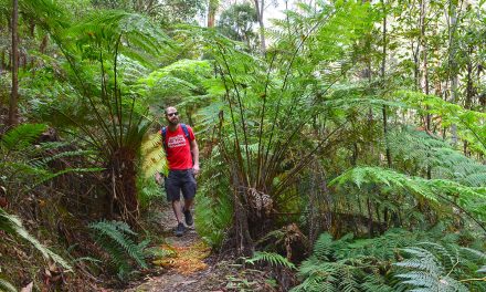
Continuing on the trail, you’ll soon reach the valley, where the view opens up, the trail flattens, and the Ponderosa Pines are around you. This is an easy part of the trail, but it’s gorgeous! The way the green pines contrast against the orange hoodoos and the blue sky makes for a vibrant picture.
You’ll also be treated to lovely views of the dramatic hoodoos around you, including some distant ones. Some of the valley’s features are fun, with rock formations resembling “castles” and “cathedrals” to admire.
After approximately 1.5 miles from where you started, you’ll reach the trail junction point. Follow the signs to continue on the Queen’s Garden Trail. Once you’ve picked up this trail, the trail comes up closer to the hoodoos again.
You’ll quickly arrive at one of my favourite spots, the Queen’s Garden Benchmark. The Queen’s Garden Trail is named for a specific hoodoo formation that does look strikingly like a regal Queen wearing a crown and in her full robes. There’s a placard that helps you identify the rock formation, and it also shows how that particular hoodoo has changed over the years due to erosion. You can look at the plaque’s old pictures and compare them to the current formation.
Once we noticed the Queen, we were suddenly more aware of the other intricate hoodoo formations in the area. They have a way of sparking the imagination. Be sure to look around for other interesting shapes – we saw dragons, a musketeer, and someone holding a lamp.
After you leave the Queen’s Garden Benchmark, the trail winds up towards the rim again. You’ll find some of the little “door-like” passageways through the rocks just beyond the Benchmark.
While some sections of the Queen’s Garden Trail have tighter switchbacks, it’s nothing quite as dramatic as Wall Street. I was still really impressed with this part of the trail. Since I had heard so much about the Wall Street section of Navajo Loop, I had assumed that perhaps the Queen’s Garden portion wasn’t fascinating. Nothing could be further from the truth. The last half mile of the Queen’s Garden Trail was just incredibly picturesque – walking right under and in between hoodoos, with their glorious colours – yellow, white, and pink layers make for intricate patterns. You’ll love the way the trail winds between the rocks, and the photo opportunities are endless. I really was just walking through it with ‘heart eyes’ popping out of my head the entire time.
Finally, the Queen’s Garden Trail ends at Sunrise Point. Now technically, this isn’t a true loop trail, as it starts at Sunset Point and ends at Sunrise Point. However, these two points are only about 800 metres (half a mile) from each other, and you can easily walk on the flat, paved Rim Trail to get back to your starting point. Alternatively, you can pick up the shuttle bus to return to Sunset Point.
I really can’t overstate how much I loved this hike. Being dwarfed by the tall, dramatic rock formations right along the trail was just epic. This hike absolutely needs to be on your bucket list.
")
Need to Know
Length: 6km / 3.2 miles
Time: 2 hrs
Grade: Moderate
Style Circuit
Path Taken: Sunset Point (there’s a parking lot here, or you can access it via Shuttle Bus) – Wall Street – Navajo Loop – Queen’s Garden Trail – Queen’s Garden Benchmark – Sunrise Point – Rim Trail (or shuttle bus) – Sunset Point
Car Access: You can drive into Bryce Canyon National Park and park at the Sunset Point trailhead parking lot. There are bathrooms and picnic tables here. The parking lot does fill up by mid-morning, though.
Public Transport Access: You can also take the Bryce Canyon shuttle bus to the Sunset Point trailhead. This bus is free with national park entry. The main places to pick up the bus are at the Bryce Canyon National Park Visitor’s Center or outside the park in the town of Bryce.
Further Info: There is a $35 entrance fee for one private vehicle for Bryce Canyon National Park, which is valid for seven consecutive days. Alternatively, if you are planning on visiting several national parks within the upcoming year, it’s worth it to buy the ‘America the Beautiful Annual Pass’, which costs $80 and gets you into all properties in the National Parks System for free.
Best Time of Year to Visit: You can visit Bryce Canyon any time of year. Wintertime regularly sees snow and ice, and some parts of the park may be closed. Summertime is actually a great time to visit, as the temperatures are much more moderate than in other parts of southern Utah.
")
Have you visited Bryce Canyon? Got it on your bucket list? If you have any stories, updates or corrections, please let us know by commenting below.
Exploring the Great Ocean Road?
You won’t see the best sights from your car. Get the definitive guidebook, featuring the 25 best walks in the area with detailed instructions and maps.


