Last Visited: 09/01/2010
Length (km): 6 km
Time (hrs/min): 2 hours 30 mins
Grade: Moderate
Return / Circuit / One-Way / Partial Circuit: Return
Region: South-West Victoria
Park: Great Otway National Park
Closest Town: Lorne (7 km)
Maximum Elevation: approx. 110 m (according to MapMyHike.com)
Total Ascent: approx. 106 m (according to MapMyHike.com)
Further Details / Source(s): We set out to do walk #1 in Daywalks Around Melbourne (by Glenn Tempest – available in many bookstores) which is a circuit walk but due to the heat we changed our minds and just did the return hike to the falls. I haven’t been able to find any significant details about this walk elsewhere.
Car Access: From Lorne, follow the Great Ocean Road west for 7 km until you see signs for the Cumberland River Holiday Park. Turn right and park in the carpark, just near reception.
Head into the caravan park and follow the track along the river until you find yourself strolling through the picturesque Cumberland Gorge, surrounded by blue gums, tree-fern and (at least when we were there) thousands of small lizards (probably skinks) and crimson rosellas).

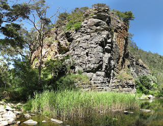
The cliffs surrounding the river are spectacular
At the first track intersection, you can choose either track as they meet not very far along anyway and you can take the other track on your return. From here the track is reasonably easy to follow and but if you start to head out of the gorge then you’ve taken a wrong turn. As far as I know there’s only one other track junction anyway, which heads north to Garvey Track (the sign was broken off at the time of my visit).

Part of the track through the gorge
The track crosses the river a few times so I would advise against it after heavy rain. When the track seems to dissappear on the side of the river you’re on, look out for it’s continuation on the opposite bank and there will usually be an easy way across. After the first 1-1.5 km the track turns from a dirt walking track to rock-hopping along the banks of the river so it does become moderately technical.

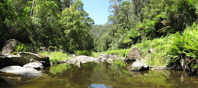
The Cumberland River (just beyond the falls)
From this point, we actually continued to rock-hop our way up the river for a short distance to explore but there is no track so it’s up to you whether you venture beyond the falls. Return via the same track.
Have you visited Cumberland Falls? If you have any stories, updates or corrections, please let us know by commenting below.
Looking for a trail that's longer, closer, or not as challenging?
You need The Trail Finder, where you can filter your way through hundreds of hiking trails.
Exploring the Great Ocean Road?
You won’t see the best sights from your car. Get the definitive guidebook, featuring the 25 best walks in the area with detailed instructions and maps.


You could do with a decent picture of Cumberland Falls. The track has improved from 10 years ago. There is a second fall above the main one and it is worth going up and over. It would be good if the locals fixed up the crossings with some boulder shifting. The first one is fine, the others not so good for the less sure footed. It is a fabulous walk otherwise. You can head up the hill on the way back towards Sheoak picnic area etc or do a round walk via Kalimna falls.
Haha I certainly could, Mike! 🙂 Thanks for the updated info. I’d love to get back there and check it out again some day soon!
Cheers
Neil
Hey Neil – Just did this really gorgeous walk last weekend – after all the rain of the last months, the river is full to the brim, and so are the falls leading into Jebbs Pool and beyond. Great time to see the Gorge at its best.