Date of Walk: 09/05/2009
Length (km): approx. 2.5 km (according to MapMyWalk.com)
Time (hrs/min): 45 min
Grade: Easy
Return / Circuit / One-Way / Partial Circuit: Circuit
Region: Melbourne
Park: Jells Park
Closest Town: Wheelers Hill
Ascent: approx. 13 m (according to MapMyWalk.com)
Maximum Height: approx. 66 m (according to MapMyWalk.com)
Map: Highlighted extract from ParkWeb Park Note (Jells Park – Ferntree Gully)
Getting There: Access is via Waverley Road, Wheelers Hill. Drive to the east end of Waverley Road, where there is a sign to Jells East Picnic Ground. Park at the southern-most end of the carpark.
Comments: There is only one track at the end of the carpark so follow this along the creek to the Jells Lake Conservation Area gate. Once inside the gate, stick to the right at all intersections to follow the lake around. The track wide and would be suitable for people with limited mobility. The Dandenong Creek Trail forms part of the circuit so this walk could be linked with other parks in the Dandenong Creek Valley (such as Shepherds Bush) if you wanted a longer walk.
Jells Park doesn’t really fit the criteria for a bushwalking location as such, but its Conservation Area has some nice vegetation and the lake features abundant bird life. I didn’t get any good bird pictures but I saw pelicans, ducks and heaps of purple swamphens. The lake was created in the 70’s as a landscape feature of the park but despite being man-made, it’s made Jells Park a much nicer place to visit.
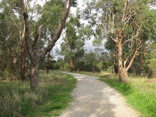
 Part of the track
 Jells Lake
 One of the wetlands in the Conservation Area


