Length (km): Unknown (GPS fail) – approx. 6 km
Time (hrs/mins): 90 mins
Grade: Easy
Return / Circuit / One-Way / Partial Circuit: Partial Circuit
Region: Melbourne
Park: Marysville State Forest
Closest Town: Marysville
Ascent: 40m
Maximum Height: 420m
Map: Highlighted extract from DSE Forest Note (Marysville State Forest)
Further Details / Source(s): DSE Forest Note: Marysville State Forest
Getting There: This walk begins near the intersection of Woods Point Road and Lady Talbot Drive in Marysville. If coming from the Maroondah Highway, turn right at the roundabout once you’re in the Marysville township and Lady Talbot Drive will be on the left soon after.
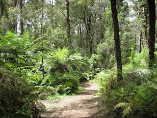
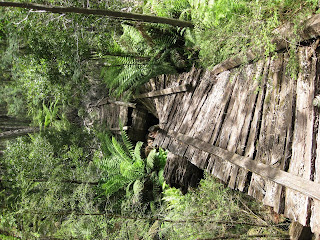
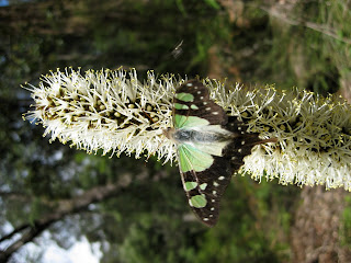
Comments: The scenery was really nice and we even had a green butterfly pose for us (see photo’s) for such a long time that we were able to get one semi-good photo. When we got to the end of the Michaeldene Track, we found that the Island Hop track was closed (“In the interest of public safety” or something to that effect) but we followed it on the South side anyway (since the fence had been ripped down), fearing/hoping that the bridges were the unsafe parts we had been warned against.

Start of Michaeldene Track

Historic Trestle Bridge

The posing butterfly


