
Last Visited: 06/12/2008
Length (km): approx. 1.1 km (according to MapMyHike.com)
Time (hrs/min): 20 mins
Grade: Easy
Return / Circuit / One-Way / Partial Circuit: Partial Circuit
Region: Melbourne
Park: Middle Gorge Park
Closest Town: South Morang
Maximum Elevation: approx. 146 m (according to MapMyHike.com)
Total Ascent: approx. 50 m (according to MapMyHike.com)
Car Access: Access is via. Plenty Road. Turn right on Gorge Road. Then turn right into the carpark with a sign saying “Middle Gorge Park” (it should be the carpark at the top of the hill, if you are next to the river, then you’re in the wrong carpark).
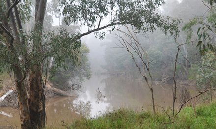
I initially tried to get to the circuit via the car park next to the river. The track is shown on the ParkWeb Park Note but it is marked as being on “City of Whittlesea land”. Anyway, I followed the track alongside the river for a few hundred metres as it became narrower and more overgrown until it finally became unpassable due to blackberries (at least as far as I could tell). At this point, I turned back and moved my car to the car park at the top of the hill. I don’t recommend trying the river track, though it did make this walk more exciting as there wasn’t much to it in the end.
Once in the correct car park, I eventually found the track that starts close to the road. I followed the unkempt, overgrown stairs down and began the circuit. It was over before I knew it and wasn’t really all that interesting, to be honest. If I lived really close, I’m sure I’d use the track regularly for fitness but otherwise, it’s not good enough for me to recommend visiting.

Have you visited Middle Gorge Park? If you have any stories, updates or corrections, please let us know by commenting below.


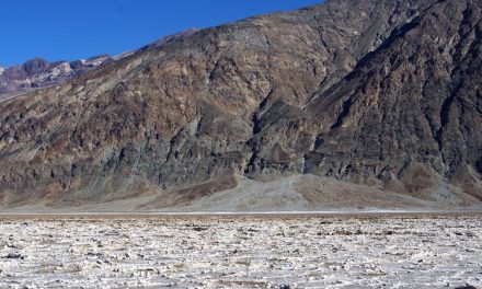
I live nearby to the Plenty Gorge and you are pretty spot on about the site. It is not a great picnic spot or anything, as the small area set aside near the toilet block is next to the road and not very enticing. However, there are some nice views of the cliff faces of the gorge along the walk from the middle gorge carpark (if one can block out the power pylons), this can be also be accessed from the lower car park via the track along the river, that has an opening up the hill after about 150 metres – although it is much overgrown. I have seen wombats and a platypus in the area (in the last year), but unfortunately I would not use the river track from October to June as I have also seen several snakes. Nevertheless, as you mention, it is good as part of an exercise routine, and this is exactly how I use the area. It helps break up the monotonous experience of walking in built up steets!