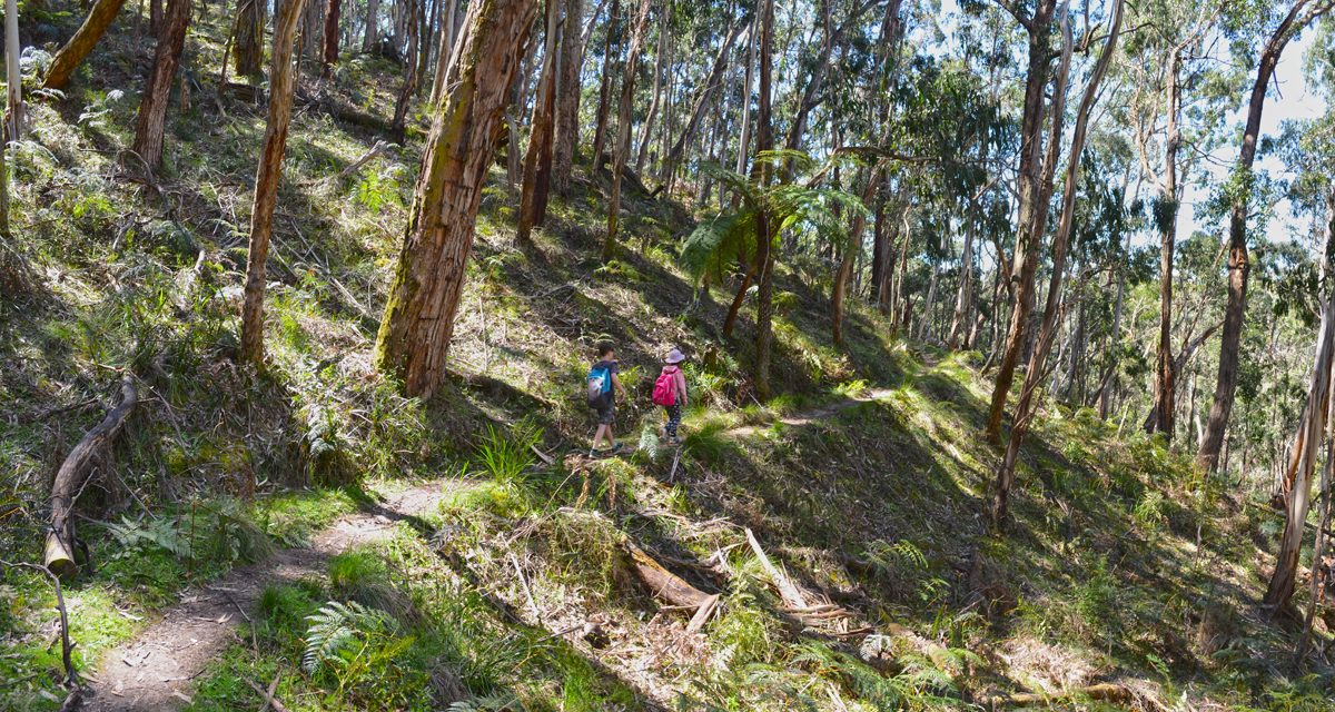
Lerderderg Gorge never ceases to amaze, especially in wildflower season. Every turn is like a new nature landscape painting on this short return trip, where the understorey of the open forest floor is decorated by every colour imaginable.
Most of the trail follows an old water race, and some sections are cut into the rock high above the Lerderderg River. Despite the name, this landscape is the real attraction of the walk and not the tunnel itself.
The Tunnel is a 150 to 200 year old river diversion tunnel, dug by hand during the gold mining era. Though it’s obviously an interesting historical site and no doubt a feat of human engineering, its entrance is currently blocked by flood debris so it’s not the significant feature it once was.
The track is easy enough to follow. Just keep your eyes out for the Byers Back Track signs and orange triangles. Make sure you head downhill to the river when you find yourself at Gribble Track. When you reach the river, flood debris makes the entrance to The Tunnel pretty easy to spot.
You can cross the river here and follow a short track over a spur to the opposite side of The Tunnel, which is more attractive. Though there was a fallen tree that made crossing the river fairly simple, I wasn’t keen on the kids doing it so I left them happily skimming rocks on the beach while I had a quick look. We returned by the same route and despite the mess that is The Tunnel’s entrance, this hike was well worth the trip.
There are other tracks in the area worth walking and the river is great for a swim in this part of the gorge. Obriens Crossing would be perfect for a weekend of car camping but make sure you avoid busy periods. The campground was busy on the weekend of our visit and didn’t have the best vibe, unless you like your camping with a side of loud music, revving engines and drunken rowdiness. I’ve only visited once but I’ve read a few other similar reports online. Not my idea of a good time.
The most common feedback I get from readers of The Bushwalking Blog is that they “just want more hikes to do”. I get it – hiking is my passion too. I do more hikes than I’d ever have the time to write about, so that’s why I’ve decided Bare Bones Bushwalking is now a thing. Not every hike has a story I can attach to it and some I just don’t get around to writing up, so in an effort to share ALL of (or at least more of) the hikes with you I’m doing this. A more simplified blog post that gives you everything you need to go and do the hike yourself. Make your own stories.
Looking for a trail that's longer, closer, or not as challenging?
You need The Trail Finder, where you can filter your way through hundreds of hiking trails.


Need to Know
Last Visited: 2017
Length: 5 km
Time: 3 hrs
Grade: Moderate / Grade 3 (according to the Australian Walking Track Grading System)
Style: Return
Region: Western Victoria
Park: Lerderderg State Park
Closest Town: Blackwood (9 km)
Path Taken: O’Briens Crossing – Byers Back Track – Gribble Track – The Tunnel – Gribble Track – Byers Back Track – O’Briens Crossing
Car Access: Head west from Melbourne on the Western Freeway for about 70 km, taking the Greendale exit toward Greendale. Turn right at the Greendale roundabout and then after about 7.5 km, turn right into a dirt road called O’Briens Road and follow it for 6 km to O’Briens Crossing campground.
Further Info: O’Briens Crossing can be busy so if you’re struggling to find a park, you may need to settle for the roadside beyond the bridge. The trailhead is a few metres from the toilet block on the south side of the river. It’s possible to turn this into a 6.5 km circuit walk, following a track along the river back to Obriens Crossing. However, neither us or any of the other hikers we met along the way could find a consistent track beyond The Tunnel.
Map: All tracks are covered in the Meridian Maps Lerderderg & Werribee Gorges 1:35,000. If you’re happy to use your phone as your map you can download the free Avenza Maps app (on Android, iPhone, or Windows) and purchase this map for AUD$14.99.
")
Have you visited The Tunnel in Lerderderg Gorge? Got it on your bucket list? If you have any stories, updates or corrections, please let us know by commenting below.
Exploring the Great Ocean Road?
You won’t see the best sights from your car. Get the definitive guidebook, featuring the 25 best walks in the area with detailed instructions and maps.


