Date Of Walk: 15/12/2008
Length (km): 2 km (according to MapMyWalk.com)
Time (hrs/mins): 30 mins
Grade: Easy
Return / Circuit / One-Way / Partial Circuit: Partial Circuit
Region: Melbourne
Park: Woodlands Historic Park
Closest Town: Greenvale
Ascent: 27m (according to MapMyWalk.com)
Maximum Height: 169m (according to MapMyWalk.com)
Map: Highlighted extract from ParkWeb Park Note (Woodlands Historic Park)
Further Details / Source(s): ParkWeb Park Note: Woodlands Historic Park
Getting There: The walk starts from the Somerton Road Picnic Area which is on the left if heading West on Somerton Road. I get to Somerton Road from Reservoir via the Craigieburn Bypass (taking the Cooper Street exit which turns into Somerton Road). It can also be accessed via Mickleham Road (off the Tullamarine Freeway).
Comments: Thought I’d explore Woodlands Historic Park a bit more today so I went to the Somerton Road Picnic Area and saw a sign to the Woodlands Flora Trail. This must be new as it’s not listed on the Park Note but it turned out to be a short loop around some wetlands (which were actually wet due to the rain over the weekend). The chorus of frog (and possibly other) noise from the wetlands was amazing!
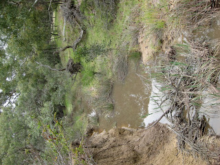
Since this wasn’t long enough for me I decided to keep going up to Woodlands Hill. As I crossed Moonee Ponds Creek I noticed it was actually flowing (again due to the weekend rain). The walk up to the hill wasn’t particularly interesting but the 360 degree view was nice.
Saw lots of Rosella’s and other birds but apart from that (and the frogs I could hear but not see) there was no wildlife to speak of.

Moonee Ponds Creek (with water!)
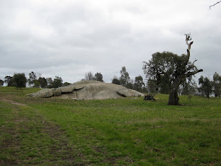
 Exposed rock outcrop on track to Woodlands
Hill summit


Hi Neil,
I tried going to greenvale.. Looks like there is no possibility to walk on the Mickleham Road to reach the walking trail. It looks like a big highway and I was not sure. I did see a pedestrian crossing signal in the Mickleham Road and Barrymore road junction, but was not sure whether we can walk on the highway after crossing the road.
Could you please let me know if you have any information?
Thanks,
Harihara Madavan
Hi Harihara,
Why did you need to walk along Mickleham Road? Do you just mean from the bus? If so, there is a footpath on the east side of the road, alongside the house fences (well away from the road). Unfortunately the closest pedestrian crossing is probably Greenvale Drive, which will take you a bit out of your way. Hope that helps.
Cheers
Neil
Hi,
I travelled in Cragieburn line train, got down at Roxburgh Park station and then took bus 484 towards Broadmeadows. I got down from Bus in the Drummond Street/Barrymore Road where there is a pedestrian crossing signal. Once we cross to the other side, I am not sure whether we can walk along the Mickleham Road after crossing.
I did walk along the foot path that you mentioned for quite some distance, but that also ends at a point where there is no pedestrian crossing or other option.
I see now. Looks like there isn’t any paved way to get there. I guess it’s up to you whether you want to take the risk of crossing the road and/or walking where there’s no pavement. Poor form on the council’s behalf but I guess it is still a developing area.
Cheers
Neil
Hi Neil,
Explored the woodlands historic park walk to some extent this time. Once you cross the Gelibrand Hill, you can see a fenced area where there is a sign telling eastern barred bandicoots are being conserved in the area. I could walk around the fenced area and in one of the place could see 10-20 kangaroos or more in their natural habitat. It was quite good walk.
Regards,
Harihara Madavan
Hey Harihara,
Glad you got to see the kangaroos this time! There are so many at Woodlands.
Cheers
Neil
Yeah pricey is right! I was mainly just asking out of interest though – wasn’t planning on buying one.
Checked out your link – looks good! Might consider that (or some variation of it) over my Christmas break (5 weeks off – YAY!)