
The beautiful region of Piedmont in northwestern Italy is often forgotten when it comes to outstanding hiking, despite the fact that there are more alpine mountains in Piedmont than in the more famous region of South Tyrol.
The highest mountain peak in Piedmont is Monte Rosa at 4618 metres, near the Swiss border. The next highest peaks are nearly unknown: the Gran Paradiso is 4061 metres and the striking Monviso, easily seen from Piedmont’s capital Turin, is 3841 metres.
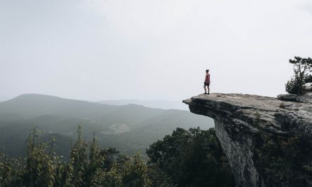
Away from the well-trodden tourist trail, Piedmont hikes feature a lot of unspoiled nature.
The signposting of the hiking trails is rather moderate, especially if hiking on the more unknown trails. The use of hiking maps or hiking apps is definitely recommended.
The name “Pied Monte” sums it up nicely: Foot of the Mountains.
1. Source of the Po beneath Monviso mountain

This hike is one of the most famous and popular circuits in Piedmont because it passes by the source of the Po, the longest Italian river. For this reason, the “Giro dei Laghi” is also very well signposted.
From Pian del Regina, the trail climbs gently across alpine meadows to Pian del Re and the source of the Po. From the origin of the 650-kilometre river, the trail climbs to the beautiful Lago di Fiorenza, in which the Monviso is reflected.
Next follows the longest and last climb to the ice-blue mountain lake Lago Chiaretto, just below the “king of stone”, as Monviso is also called. Gently downhill the path turns back towards the starting point. The beautiful trail passes Lago Lausetto and the popular bathing lake Lago Superiore. Along the mountain slope, with fantastic views on the source and the valley you then hike back to Pian del Re and the starting point at Pian del Regina.
Need to know
Length: 10.7 km
Time: 4 – 5 hrs
Difficulty: Moderate
Style: Return
Access: Start from Pian del Regina (or to shorten the trek by an hour, start from Pian del Re). Both locations are accessible by car and have big car parking spaces. Pian del Re does cost € 10.00 for the day. Pian del Regina is free.
Further Info: 4-Lake-Hike from Pian del Regina on Hiking the Alps
2. Military fortresses at Colle di Tenda

The historically important Alpine pass Colle di Tenda is now an excellent starting point for beautiful hikes along the Italian-French border. One of many outstanding hiking options in the area leads from one ancient military fortress to the next and up to the summit of Rocca dell’Abisso.
The best part of that hike: the ruins are all freely accessible and inhabited only by chamois and ibex. From the Forte Centrale on the Colle di Tenda, we hike west along the French-Italian border. Passing Fort Pernant, the trail on the French mountain site leads to Fort de Giaura. If you want, you can take a break here and hike back along the Italian territory. Those who still have strength should make the climb and another 500 meters of altitude to Rocca dell’Abisso. On a clear day, this feat of strength is rewarded with fantastic 360-degree views, as far as Switzerland and the Mediterranean Sea. To Fort de Giaura you return along the same path. To reach the starting point at Colle di Tenda, you want to hike the easier and wider path on the Italian mountain slope.
Need to know
Length: 22 km
Time: 6 hrs
Difficulty: Difficult
Style: Return
Access: Start and finish point is the parking area at Charlet Marmott, just beneath Colle di Tenda, above the village Limone Pimonte.
3. Lago Rosset / Gran Paradiso National Park

Gran Paradiso National Park is the oldest and wildest national park in Italy. It has existed since 1922 on the border between Piedmont and Valle d’Aosta, protecting more than 70 hectares of almost untouched nature. It offers plenty of outstanding hikes on hunting trails built by the former Italian king Vittorio Emanuele II. An easy and beautiful one starts in the heart of the park, on the beautiful Nivolet plateau, and circles the amazingly blue mountain lake Lago Rosset.
From the parking lot at Rifugio Savoia, it is only a short 20-minute gentle climb to the beautiful lake where people love to sit and picnic. On its right side, the path continues to climb gently, giving fantastic views of the 2nd highest mountain in Piedmont and name giver of the National Park. Then it continues close to the lake and stays alongside its border until the starting point.
Need to know
Length: 4.3 km
Time: 1.5 hrs
Difficulty: Easy
Style: Return
Access: Starting point is the free parking in front of the Rifugio Savoia on the Nivolet Pass. In summer, Ceresole Reale offers a free Shuttle from the village to the Rifugio which runs very frequently and is very recommended to use.
Further Reading: Gran Pardiso National Park on Hiking the Alps
4. Forte di Fenestrelle and one of the most beautiful villages in Italy

The hike from Forte di Fenestrelle through the beautiful village of Usseaux and to Lago del Laux offers an outstanding combination of culture and gorgeous Piedmontese nature. The impressive Fenestrelle Fortress is not only the largest fortress complex in Europe but after the Great Wall of China, also the next largest masonry. The structure consists of actually 3 fortresses which stretch over 635 meters of altitude up the mountain, on one valley side of Val Chisone. Inter-connected are the military buildings, by the longest covered staircase in Europe, consisting of 4000 steps.
From the parking lot of the fortress, the trail “Strada dei Cannoni” zigzags up to the uppermost fort. The path leads westwards along the mountain slope, with a beautiful view of the Val Chisone now far below. Through the almost abandoned hamlets of Pequerel and Puy, the trail gently accents to Usseaux. This beautiful village belongs to the association “i borghi piu belli d’italia” (the most beautiful villages in Italy) because of its murals. You will find them on nearly all houses. After crossing the main Val Chisone valley street, you will be passing the idyllic mountain lake Lago di Laux. Via the hamlet of Laux, the trail leads through the village of Fenestrelle back to the fortress.
Need to know
Length: 19.5 km
Time: 6 hrs
Difficulty: Moderate-Difficult
Style: Return
Access: Starting and end point is the parking from the Forte di Fenestrelle, just above the Fenestrelle village in Val Chisone.
5. 13 Lakes above Val Germanasca

The “altopiano dei 13 laghi” is a plateau, high above the village of Prali in the narrow Val Germanasca, which is home to more than 13 lakes. Even if the hiking route does not pass all of them, this is still one of the best hikes in Piedmont. It is one of the few hikes that require the use of a chairlift. Of course, you could also walk to the hike’s starting point, but the plateau of the 13 lakes lies 1000 meters higher than the valley floor.
After a 20-minute ride on 2 chairlifts, you reach the plateau, which is rich in views. This beautiful round tour is signposted from the chairlift mountain station Bric Rond with “A” or also “Giro dei Laghi” (Lakes Roundtrip). First, you walk gently downhill on the mountain slope to the blooming plateau with the first mountain lakes. There are also old military ruins, now used by farmers with their cows. The trail then continues uphill along a stream, above the plateau past some more mountain lakes. A highlight is the Lago die Canonni. On its shore, there are 2 old cannons. A last, somewhat demanding climb goes up to a rocky plateau from which the entire covered hiking trail can be overlooked. Along the mountain slope, above the plateau, you hike back to the chairlift, with magnificent views of the plateau.
Need to know
Length: 7 km
Time: 2.5 hrs
Difficulty: Easy – Moderate
Style: Return
Access: Start and end point is the mountain station Bric Rond of the chairlift. The Valley Station is located in Malzat, just behind the village of Prali, at the end Val Germanasca. There are lots of free parking spaces opposite the lift station.
6. Border hike from the highest sanctuary in Europe

Sant Anna di Vinadio is the highest sanctuary in Europe. It’s located on the outermost edge of the Valle Stura, just over 2000 metres, and offers fantastic views into the valley (close to the French border). Here starts the outstanding circular hike “Tour du Lausfer” (it. Giro dei Laghi). This fantastic, panoramic high-altitude hike leads mostly on wide military paths and is therefore also suitable for families. Along the trail, you will cross 4 alpine passes (Colle di Sant’Anna, Col du Lausfer, Col du Saboulé and Passo Tesina), which are partly also border passes to France and also pass many beautiful mountain lakes.
Tip: Don’t forget to bring your swimsuit. If the weather is good, you should go swimming at Lago di Sant’Anna.
Need to know
Length: 11.8 km
Time: 4 hrs
Difficulty: Easy – Moderate
Style: Return
Access: Starting point is the parking area at the Santuario Sant’Anna di Vinadio in Valle Stura.
Futher Reading: Tour du Lausfer at Hiking the Alps
7. Barolo Wine country

A very different landscape can be found in the centre of Piedmont, south of its capital Turin. Here the rolling hills of the Langhe, Monferrato and Roero wine-growing areas, recognized by UNESCO, predominate. Gourmets and foodies will love hiking in between the rustic villages as you will get fabulous local specialities and a good glass of wine everywhere.
Whether it’s the grape harvest in autumn, frozen fields in winter or spring when everything is in bloom, a hike among the wine hills is always worthwhile.
A good starting point is the famous wine village of Barolo. The vineyards around the picturesque village produce the world-famous red wine.
After having visited the castle of Barolo follow the signposts to Novello. Through the fields and over rolling hills, the trail leads to the neighbouring village, from where there are magnificent views across the fields and to the Alps. Continuing over hills and through vineyards, you will reach the medieval village of Monforte d’Alba which belongs to the association of the most beautiful villages in Italy. Its narrow, car-free roads wind up the hill and end at the small amphitheatre and a medieval bell tower. The scenic return path to Barolo also takes you back through vineyards and rolling hills.
Need to know
Length: 14 km
Time: 3.5 hrs
Difficulty: Moderate
Style: Return
Access: Start point is the famous Wine village of Barolo. There are lots of free parking spots in and around the centre.
Further reading: Barolo Wine hike on Hiking the Alps
8. GTA (Grande Travessa delle Alpi)

The GTA (Grande Travessa delle Alpi) is the most famous long-distance trail in Piedmont. The beautiful hiking trail through the Alps leads hikers for about 1000 kilometres in 65 daily stages along the entire northwestern Italian Alpine arc from Monte Rosa in Valais to the Ligurian Alps and the Mediterranean Sea.
The GTA passes many of the above-mentioned hiking highlights in Piedmont. The trails follow mule tracks and easy paths, from valley to valley, usually with one pass per day to overcome. At the end of each stage, there are overnight accommodations (“posto tappa”) marked with red-white-red GTA labels.
The GTA is usually snow-free from the end of June and can then be hiked until the end of September. That long-distance trail is without technical difficulties. Except perhaps in the north, near the Swiss border, where the stages are sometimes quite long.
Need to know
Length: 1000 km
Time: 65 days
Difficulty: Difficult
Style: One-Way
Access: Easiest north access is the village of Forno in Valstrona and easiest south finish point Viozene, close to the Ligurain boarder. Those points are reachable by car and public transport.
Have you been hiking in Italy’s Piedmont region? Got it on your bucket list? Got any questions, comments, updates or corrections? Let us know by commenting below.


