Date of Walk: 12/01/2009
Length (km): 4.7 km (according to MapMyWalk.com)
Time (hrs/min): 1 hr 30 mins
Grade: Moderate (according to “Daywalks Around Melbourne”)
Return / Circuit / One-Way / Partial Circuit: Return
Region: Western Victoria
Park: Mount Beckworth Scenic Reserve
Closest Town: Clunes
Ascent: 262m (according to MapMyWalk.com)
Maximum Height: 634 m
Map: Highlighted extract from ParkWeb Park Note (Mount Beckworth Scenic Reserve – Visitor Guide)
Further Details / Source(s): #28 & #29 in Daywalks Around Melbourne (by Glenn Tempest – available in many bookstores) and ParkWeb Park Note: Mount Beckworth Scenic Reserve – Visitor Guide
Getting There: From Melbourne, take the Western Freeway and exit after Ballarat, to Clunes (Clunes-Maryborough Rd). After the town of Minors Rest, veer left onto the Coghills Creek Road. After the town of Coghills Creek, turn right onto Fentons Road and soon after the road turns to gravel, take a left turn along Mountain Creek Road. Enter the park gates and turn right to The Dam, which is the first picnic area you will come to along this road. After the right turn, make sure you stick to that road and don’t take the next left.
Comments: According to “Daywalks Around Melbourne”, the track from The Dam to The Oval is signposted but it appeared that the signs had been torn down (if there ever were any). There were also a lot of unofficial tracks everywhere, presumably due to people riding motorbikes around the area (there was somebody doing donuts on a four-wheeler near The Dam when I arrived). However, once I walked west towards the hill I found a very well defined track to follow. This track brought me to The Oval.
Once at the oval, there was a track worn into the grass which led to the Northern Ridge Track. I was initially planning on completing the “Cork Oaks Loop” (#28 in “Daywalks Around Melbourne”) and although I found the track from The Oval to Cork Oaks, I couldn’t follow it and decided not to continue since I was alone and didn’t have a good map. At this point I decided the walk to the summit and back would be hard enough work anyway! So rather than turning off to the right, I followed the sign to the summit.
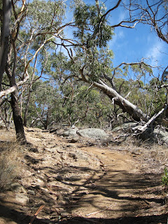
The rest of the walk was very physically challenging (I’m very unfit but in my defence it was about 35 degrees!) but there were no more tricky bits (just keep going UP!). The tracks were very well defined but were extremely steep in parts and quite slippery and rocky.
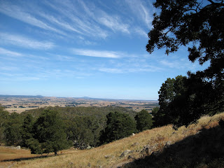
No sign of any wildlife apart from a few magpies but the views to the surrounding hills and wind-farms were beautiful

Northern Ridge Track

View from near Mt Beckworth summit


