Last Visited: 1/11/09
Length (km): approx. 12 km
Time (hrs/min): 3 hours
Grade: Easy
Return / Circuit / One-Way / Partial Circuit: Partial Circuit
Region: Melbourne
Park: Kinglake National Park
Closest Town: Kinglake
Maximum Elevation: approx. 642 m (according to MapMyHike.com)
Total Ascent: approx. 288 m (according to MapMyHike.com)
Car Access: Kinglake is 65km north-east of Melbourne. From Kinglake township, head north-east on Glenburn Road and keep an eye out on the right for a dirt road with a sign saying Mountain Creek Track. I parked at the beginning of Mountain Creek Track (off to the side so as not to block the track) but if you’re in a 4WD you can head up Mountain Creek Track and park at the gate on the right (Melways Ref: 79 H2).
Having noticed on the Kinglake National Park page at the Parks Victoria Website that some of the tracks up at Kinglake had reopened (since being closed due to damage from the Black Saturday Bushfires in February ’09), we decided to head up and check it out and we were far from dissapointed! It was great to see how well things are regenerating and as always, it was amazing to be walk around the burnt landscape.
If parked at the beginning of Mountain Creek Track, head up the track and follow it through the closed gate (on your right, where there is a Kinglake National Park sign – pictured below). You will soon pass a small unmarked walking track on your right but keep walking until you have passed Stringybark Track and take the next left on Dusty Miller Track (the two aforementioned tracks are also unmarked but this is probably due to the fire).
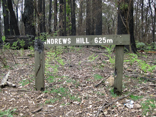
Dusty Miller Track ends at it’s intersection with Andrew Hill Track, which is the summit of Andrew Hill (the highest point in Kinglake National Park at 634 m). We turned left (north) and walked a couple of hundred metres to where, had it been a clear day, there would have been a nice view to the west. At this point we turned back and continued south-east along Andrew Hill Track for a (partially) different route back to the car. Ignore the next track on your left and continue back along Mountain Creek Track to the car.
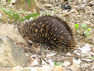
My hiking partner for this hike had visited Kinglake very soon after the fires and noticed that everything seemed very quiet at the time because of the lack of birds but we noticed a chorus of bird sounds as soon as we got out of the car. The undergrowth was still sparse after being burnt so it was easy to spot two echidnas at different points along the way. Unfortunately, they still managed to see us coming before we saw them, so we only got to see their spiny backs!

One of the shy echidnas tries to hide from us
Note: I’ve included all the required information for doing this hike here but for more of a description (and probably the best of my photos), you might also like to check out my story in the February/March 2010 issue of Great Walks Magazine.
Have you visited the Kinglake National Park yourself? If you have any stories, updates or corrections, please let us know by commenting below.


Hi Neil, we are taking 20 people on ‘A day in nature’ Event and our destination is Kinglake, do you think this is a good tarting point or do you know something else.
https://www.facebook.com/events/556710174396361/?ref=2
Hi Colin,
If you’re wanting a walk of decent length in Kinglake, this is the best one that I know of at the moment. My favourite used to be the ~14km circuit at Masons Falls, but it’s been closed since Black Saturday.
If the walking distance isn’t so important, I’d suggest a visit to Masons Falls or Wombelano Falls, as they make nice features for a visit to Kinglake National Park.
Have fun! 🙂
Cheers
Neil
i'm definitely going to do this asap! 🙂 Haven't been to Kinglake before. This would be a good start. Maybe I'll spot some echidnas, hopefully 😉
the last picture looks very sad, but hopeful at the same time, with all the new young growth on the trees.
many thanks for the post!
louis.
That's exactly the way I see it!
Shouldn't be too hard to see some echidnas. Let me know if you get a better photo than I got.
Thanks for reading!
Cheers
Neil