Date of Walk: 30/05/2009
Length (km): Unknown (I’d estimate that it’s not much more than 1 km)
Time (hrs/min): 20 mins
Grade: Moderate
Return / Circuit / One-Way / Partial Circuit: Return
Region: Melbourne
Park: Macedon Regional Park
Closest Town: Mount Macedon (6 km)
Ascent: Unknown
Maximum Height: 1008 m
Map: Not necessary (clearly shown on the maps in both of the Park Notes below)
Getting There: Access is via Cameron Drive, which is off Mount Macedon Road. Shortly after you turn on to Cameron Drive, park at the McDonald Reservoir car park on the right.
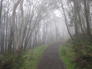
Comments: The track to the summit starts near the information shelter at the east side of the carpark. There is only one junction in the track and this is near the summit. However, it heads back down-hill so it is kind of obvious which one to take (there is also a sign).
The track is wide and easy to follow but steep enough to get the heart pumping. The vegetation was really nice and was made all the more mystical by the foggyness. As you can see from my photo (below), the fog did kind of spoil the view from the summit though!
 Part of the track
 The “view” from the summit viewing platform


