
Date of Walk: 31/05/2009
Length (km): 2 km
Time (hrs/min): 45 mins
Grade: Easy
Return / Circuit / One-Way / Partial Circuit: Circuit
Region: Melbourne
Park: Warrandyte State Park
Closest Town: Warrandyte
Ascent: approx. 28 m (according to MapMyWalk.com)
Maximum Height: approx. 73 m (according to MapMyWalk.com)
Map: Available in the ParkWeb Park Note: Warrandyte State Park – Jumping Creek Nature Trail (NOTE: Sections of track that appear to run alongside the management vehicle track don’t seem to actually exist, so just walk along the management vehicle track and keep an eye out for the signed walking tracks to continue along)
Further Details / Source(s): ParkWeb Park Note: Warrandyte State Park – Gold Heritage Trail.
Getting There: Access is via Jumping Creek Road, Warrandyte. The entry to Jumping Creek Picnic Ground is well-signed (Melways Ref: 24 A9).
Nearby: Mount Lofty is by far the most popular place for a Warrandyte walk, followed closely by Pound Bend. Black Flat and the Warrandyte Gold Heritage Walk are also worth a look. In the warmer months, you might even want to consider a kayaking tour on the nearby Yarra River.
Comments: The walk begins at the north side of the carpark. I recommend starting along the track closest to the river. All junctions are well-signed but my only confusion (as I mentioned above) was where the walking track on the map appears to follow alongside the management vehicle track. There is actually no walking track alongside the vehicle track so I just walked on the vehicle track until I saw signs pointing out the walking track.
This is one of the nicer spots I’ve been along the Yarra River. As usual, there was lots of birdlife but I wasn’t lucky enough to see any other animals such as the wombats and swamp wallabies that mentioned in the Park Note.
 The Yarra River from the track
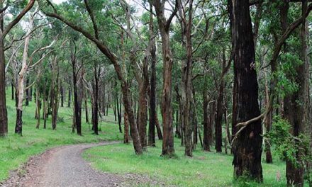
 Part of the track


Thanks for the hard work in keeping this blog going; it’s a great resource. I hiked this trail on 15 April 2012, and your tips were excellent. One further note: It looks like there was some recent storm damage on the trail between markers 7 and 10. Trees were down across the trail, overgrown bush, etc. Nothing very challenging, but families with little ones or people with special needs might consider sticking to the vehicle track between markers 6 and 11 if they want to avoid this. It is a beautiful nature trail though!
Hi John,
That's definitely something to add to the list! I've only done a couple of short hikes in NSW and that was back in January '07 – I think they were both somewhere around Katoomba but I wasn't keeping track of these things back then. Very interested in getting up that way for some more hiking soon! Thanks for the heads up!
Cheers
Neil
Hello, We're in NSW, though we've walked a bit in Victoria too. We wondered if you'd been as far afield as Sydney? For example, The Great North Walk is a truly wonderful trail of 250 km between Sydney and Newcastle. To find treasure hunt elements, including beautiful engravings; historic and peculiar obelisks; and mysteries that have occurred along The Great North Walk: murders, disappearances and inexplicable deaths
Have more fun!
John
Thanks heaps for the comment Adam! It´s great to know it´s being appreciated!
Great pictures and a great resource.