Knowing that I’m very much not a hiker, Neil promised me that our trip to the Blue Mountains would involve a few relatively easy day walks.
I must have done so amazingly well on our first hike, that he decided to test me a bit. That’s what I’m telling myself, anyway.
Because I’m not sure the Grand Canyon walk falls into the ‘easy’ category. In fact, closer inspection tells me it’s actually graded as ‘Hard’. I should have known better- the name itself sounds ominous.
The Grand Canyon Walk is a giant loop track that begins and ends on Evans Lookout Road in Blackheath, about fifteen minutes’ drive up the mountain past Katoomba. The beginning of the track is easy to find- you enter scrubby bushland directly from the appointed car parking area and follow trail down into the canyon itself.
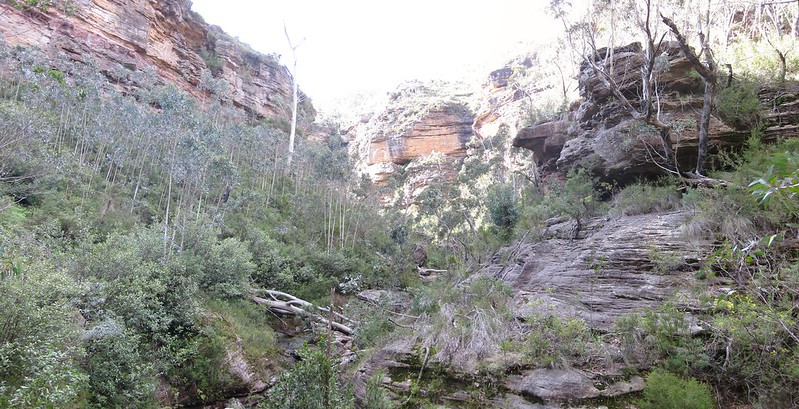
The relatively well marked and maintained track zigzags down the slope, and the scenery becomes greener as you descend. The sandstone rock-formations and overhangs are amazing. We’ve gone no more than five hundred metres when Neil and I agree that, even if got no better than this, it was worth it.
It takes maybe thirty minutes to reach the river that flows through the Grand Canyon. On our way down, we pass through two lockable gates designed to shut the walk off at various points. We’re extremely lucky– this track reopened only three days before we arrived, after being shut for a week or so due to heavy rainfall in the Blue Mountains. It’s recommended not to canyon or hike here if rain is predicted at any time during the day, as flash flooding is common and can be extremely dangerous.
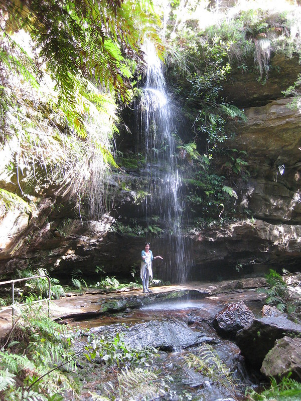
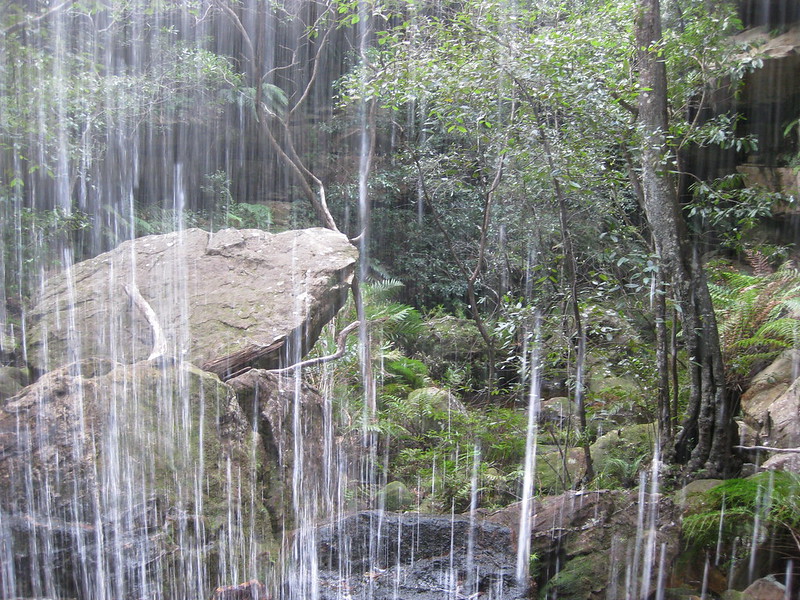
Having said that, the few days after a heavy rainfall is an amazing time to be in the Canyon. I lost count of how many waterfalls we saw, from high misting sheets of water to tiny trickles of rushing rivers that splash and spill over rocks.
The entire floor of the canyon is rainforest, and it all seems to be green. There are a million shades of green down here, of moss and ferns and slippery rocks.
We follow the Greaves Creek along where it’s cut its path through the middle of the massive rocks. The foliage is massive and looks almost prehistoric. We cross the riverbed several times, using the sturdy carved sandstone blocks as stepping stones. Getting wet feet is inevitable.
There are quite a few other hikers out today and about halfway through, it dawns on us that every other group we see is walking the opposite direction to us. It seems we’ve actually done this hike backwards. That’s confirmed when we come across the ‘entrance’ and warning sign for the canyon, after we’ve already come through it. That’s not really a problem, of course, except it means we’ve done the short ascent as a short descent. I get the feeling I’m going to suffer on the climb out of the canyon.
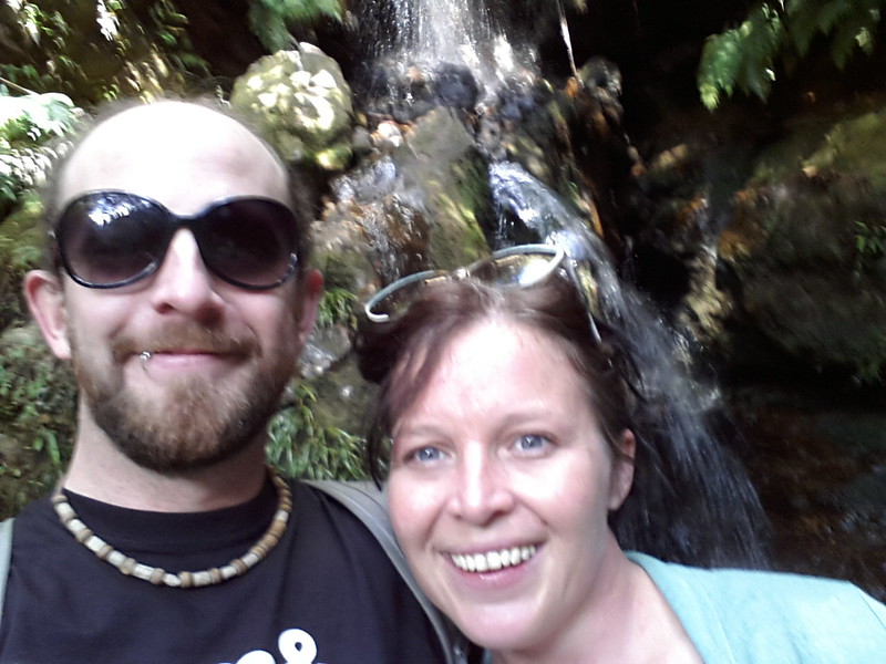
A lot of the track from here is across sandstone ledges, with overhangs that sit a few feet above our heads. At one bend in the river, we see a large rock that some hikers had secured as a perfect picnic spot, spreading out their lunch in the sunshine. Just fifty feet behind them, the track actually goes under a waterfall. It’s only a small one, but bathed in the winter sunshine it looks pretty glorious.
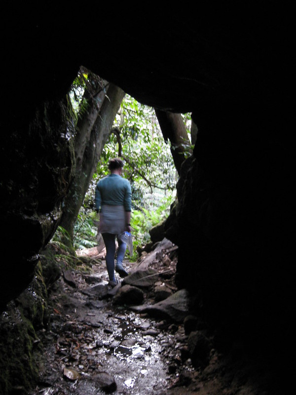
Just after the waterfall we come across a sandstone tunnel that forms part of the Grand Canyon walk. It’s a small, dark, fifteen foot stretch of blackness where huge pieces of falling rocks have left a gap big enough to walk through- it’s about three metres from floor to ceiling.
After two hours of walking, we seem to be on the final stretch. To my slightly unfit dismay, the track just goes up and up and up. The steep incline is offset by more zigzagging stairs, and our surrounds are unbelievably pretty. The bright rainforest foliage gives way to dryer, scrubby bushes and the stairs still seem to be going up. I’m breathing heavily and really just want to go home.
Reaching the end of the track- our start point back at the car- felt almost excessively triumphant. I’m exhausted. I will remain exhausted for the next two days.
But I’m still proud of myself. Aching, tired muscles or not– that was fun. I can’t wait to do it again.
Last Visited: 05/07/2013
Length (km): 6 km
Time (hrs/min): 3.5 hours
Grade: Moderate (although the NSW National Parks website calls it Hard)
Return / Circuit / One-Way / Partial Circuit: Circuit
State: NSW
Park: Blue Mountains National Park
Getting There: Turn east off the Great Western Highway (in Blackheath) into Evans Lookout Road, then follow the signs to Evans Lookout. Parking is available at the lookout.
Eating & Sleeping: If you’re after some creature comforts on your trip to the Blue Mountains (as we were), I can recommend staying at Three Explorers Motel. It was extremely nice for the price. For a tasty, affordable meal, try Pomegranate Cafe, or the awesome courtyard at Vee’s Cafe.
Have you visited Grand Canyon Track? If you have any stories, updates or corrections, please let us know by commenting below.
Are you interested in more from Bushwalking Blog? You can either sign-up for the e-mail newsletter, or get updates via the RSS feed, Facebook or Twitter.




Love the panoramic shots, stunning. Will have to get to NSW to do this one day!
Thanks Tim! The Blueys are definitely worth a trip!
Cheers for the comment.
Neil
Great article & photo’s, I’ve not done this walk for about 20 years & that was wiith my ex before we got married…. need to take my current wife & overwrite the memories with new ones!
Glad you enjoyed, Michael! Yes, definitely a good idea to do it again and an even better idea to overwrite those memories! 🙂
Cheers
Neil